| OUGS | OUGS Ireland | Branch Field trips |
O.U.G.S. Field Trip to Meath. 6th of August, 2,000 with Robbie Meehan
Few of us can visualise Ireland buried beneath 1000 metres of ice but Robbie Meehan gave us an understanding of conditions 10,000 years ago during our field trip on 6th of August, 2,000.
At Trim Castle we saw how the castle was built on bedded Calp Limestone outcropping on the banks of the River Boyne. This limestone underlies all the glacial deposits in County Meath. Travelling towards Summerhill on a narrow country road, we stopped and looking over the hedges, found we were on the ridge of an esker which was about 15 metres above the adjoining fields. This is part of the Trim Esker which is many miles long and is estimated to contain 20 million tons of gravel. In this area there are nine eskers spaced 1 to 3 kilometres apart representing conduits for meltwater in and under the ice. Rocks and gravel accumulated in the bottom of the ice tunnels,raising the level of the bed while the water melted the ice in the roof of the tunnel.
Eskers are a prominent feature of the Midlands where they can be 20 metres high and 100 metres across at the base, the most famous being the Esker Riada which carried the road to the West high above the boggy ground. They are covered by a thin layer of organic material.
The Galtrim Moraine is comprised of fans and deltas of gravel built at the ice margin into glacial Lake Summerhill. This lake formed when water was trapped between the ice front and the high shaly ground at Summerhill. The building outwards of successive deposits is evident and above them, a later horizontal layer.
An interesting snippet was about the rock cutting in the Glen of the Downs which could have been cut in one week when the vast lake stretching from there to Lugnaquilla broke over the top of the ridge.
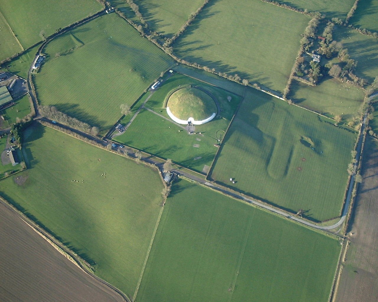
In a visit to Tara, we learned of its archaeological importance on a limestone hill. From there it is possible to trace the path of the River Boyne which had flowed eastward into the bed of the River Nanny. This channel was blocked so the river turned northward cutting deeply into the rock through Navan and Slane.
Near Oldcastle there are four prominent hills of rocks of Lower Palaeozoic age which have on their summits the Loughcrew Megalithic tombs similar to those at Newgrange Those hills were smoothed by the last glaciation when the ice plucked the rock on the steeper southern side in typical roche moutonnee form.
Sandstone erratics were carried to the top of the ridge from a source in the northwest. There is a sharp contrast between the land to the north and the south. Southward is limestone country which is well drained and flat while the land northward is on impervious Lower Palaeozoic rock. Here the passage of the ice caused the formation of drumlins, all oriented and elongated in the same direction.
Con Murphy
Newgrange. a prominent archeological site in Co Meath. The opening is aligned to the winter solstice.
Photo by Joe Leahy
| OUGS | OUGS Ireland | Branch Field trips |