Towns & Villages of Slieve Margy
Arles
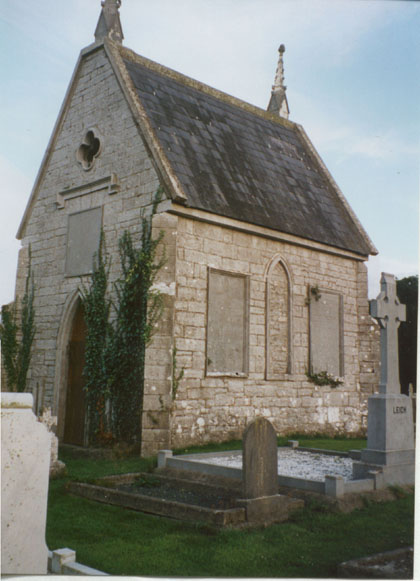
Arles: The Fortified Hill. A descendent of the local Grace family, William
Russell Grace founded the well known international company W.R. Grace
& Company (1854). In 1885 William was Mayor of New York and he accepted
the Statue of Liberty from the French on behalf of the American people.
The graveyard contains a very fine Grace family mausoleum.
![]()
Ballickmoyler
Although a small village today, in the middle of the 17th Century, Ballickmoyler
was a considerable settlement with a population of 127 families. During
the1798 Rising, it was a point of assembly for 600 pikemen and 200 riflemen
of the Queen's County Corps before their march on Graigue for the disastrous
Battle of Carlow. Half the village of Ballickmoyler lay in ruins in the
wake of '98. Adjacent to Ballickmoyler is the townland of Cappalug, noteworthy
as the location of what is possibly the oldest surviving house in the
County.
Ballylynan
Ballylehane was the scene of the great slaughter of the O'More Clan (300
killed) in 1315. But in 1346, the castles of Lea, Kilmeade and Ballylehane
were taken by the O'More, O'Connor and O'Dempsey clans. This castle came
into the possession of the Hovenden family in the mid 16th Century. Ballyadams
Castle was built in the 15th Century. The castle was taken by the Earl
of Desmond in 1548 after the O'More's had burnt the town of Athy. By 1551
it was in the possession of a Welshman, John Bowen, the renowned Shane-a-pika.
Ballylynan Castle was said to belong to the O'More's but it fell to the
Grimes or Grahams after the Battle of Agharoe (the field of blood). The
landlords of Ballylynan were the Weldons who came during the reign of
King James I, and they remained landlords up to the 1920s. When the Weldon
estate came into being at the end of the 17th Century, Ballylynan was
no more than a small cluster of cottages. It owes its development to two
factors, the proximity of Rahen House, main house of the Weldon Estate,
and its location on the Athy- Castlecomer Road which provided access to
the mines.
Barrowhouse
Barrowhouse, as it is known today, was originally two regions, Fasaghreban
and Feranclan-ui-donal. One of the most significant landmarks in the Barrowhouse
area is Dunbrin Fort, which is reputed to have been a Danish Station,
because of coins found there. On the 16th of May, 1921, two of a group
of eight IRA volunteers were shot dead during an ambush on the Black and
Tans, who regularly passed through the area going to Ballylynan. Today,
the area is marked with a memorial to the deceased, William Connors and
James Lacey.
![]()
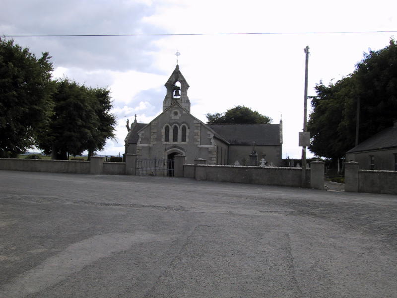
Graiguecullen
Lying in the deep valley of the River Barrow, Graiguecullen is geographically
situated in Co. Laois. Known for many years as either Slatty-Graigue or
Carlow-Graigue the name was changed in the 1920s to Graiguecullen in honour
of Fr Hugh Cullen a local parish priest who died in 1917.

![]()
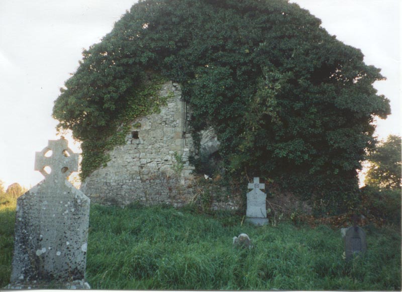
Killeen
Killeen was part of the ancient Kingdom of Slieve Margy, and its inhabitants
were under constant attack from invaders from Carlow and Kildare. The
Christian era brought greater stability and this was marked by the foundation
of a monastery in Killabban by St Abban, which is now in ruins.
![]()
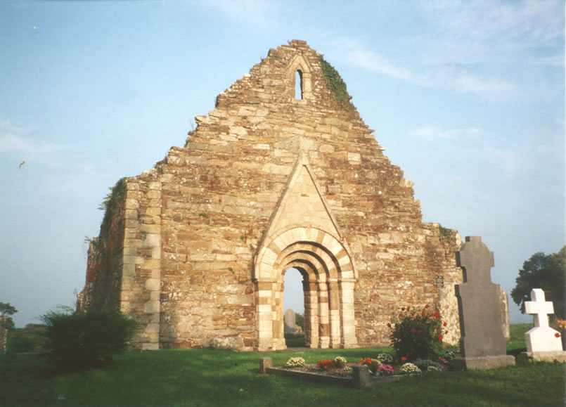
Killabban
In the 7th century St. Abban founded a monastic settlement. The area is
named after him and his settlement: Killabban, the Church of Abban. In
fact there are a great number of monasteries and churches recorded as
being erected by St Abban in various parts of Ireland. He is also believed
to have lived for over 300 years. There were probably two St Abbans who
lived at different times and places. The coming of the Norman's meant
that the proximity of the River Barrow became more significant, and this
led to the building of a manor in Killabban. Castles were also built at
Grange and Shrule (c.1180 by Hugh de Lacey) at important crossings on
the River. Today there are no remains of the Castle at Grange or the manor
at Killabban. The square keep still stands at Shrule.
Killeshin/ Rossmore
The name Killeshin is derived from Gleann Uisean - the Glen of Oisin.
Oisin was the son of the legendary Celtic Warrior Fionn Mac Cumhaill.
Oisin was raised in this area and later he became the most famous poet
in ancient Ireland. Oisin is best remembered in Irish legends for his
love for Niamh of the Golden Hair and their journey to Tir na nOg, the
Land of Eternal Youth. In the sixth century St Diarmuid founded a monastery
at Killeshin. Rossmore derives its name from the Great Woods that once
covered the hills. Through Coillte the hills are again heavily forested.
Rossmore coal/ iron mines were a great source of employment.
![]()
Mayo -Doonane
Mayo means the place of the Yew trees, so named during Norman years (12th
- 13th centuries). The trees were used by Norman archers to make bows
and arrows. A Norman Castle and moat was built on the site of the present
Tolerton Hall, which was originally a Roman Catholic School. Doonane,
meaning the little fort, is described as consisting of a portion of the
abbacy of St. Abban, and the parish of Rathaspick. It was renowned for
its stone and coal quarries, which supplied much of the surrounding hinterland.
The Rushes
So called because of all the rushes that grow in the area. There was a
small village in the area called the Bull Ring where approximately thirty
four families lived. Most of them worked in the local mines. In 1807,
Sir Charles Henry Coote Bart built a school near the village. The village
has since disappeared and the school closed in 1975.
The Swan
This is one of the newest villages in Co. Laois & it is named after
the pub!! In 1935 to create employment in the area Mr P.J. Fleming opened
a Fire Clay Factory because all fireclay products were imported. The Swan
offered an ideal location because it was at the centre of the fireclay
deposits and local coal provided the energy source.
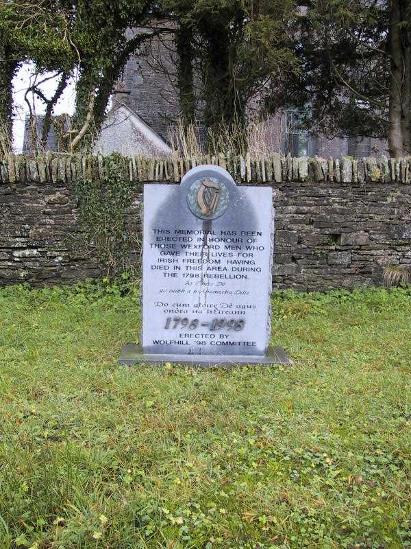
Wolfhill
The Hill of the Howling Wolves. Similar to the Swan & Rossmore areas
mining was extremely important to the area. Wolfhill is an area rich in
archaeological evidence. The "Ass's Manger" is probably a neolithic/
bronze age tomb. A Druids Alter (chambered cairn) probably dates from
the same time period and was quite possibly used as a pagan place of worship.
The altar gives its name to the townsland, Monamanary: the Plateau of
the Druidesses. There is evidence that a stone circle surrounds it, the
origin & usage of which are uncertain

![]()