This is the old BHC news page.
The new version is on the club blog.......link on
the main
club website.
Posted 27th of July
2007
"If anyone is interested the BBC are
commencing a new series on Sunday next 29 July on walking the mountains
of Britain. From what I have seen on the trailer it looks
promising.
The following is the detail on the first episode: Mountain, Sun 29 Jul, 9:00 pm - 10:00
pm 60mins BBC1 ,
No. 1 of 5 - Northern Scotland
Griff Rhys Jones begins his exploration of Britain's mountains in the
breathtaking wilderness of the northwest highlands of Scotland. The
vast and empty landscape in the far north of Britain can seem
uninhabitable, but those who live here have an extraordinary connection
with the land. The people have been shaped by the landscape in which
they live, and by its rich history and culture. Nowhere else in the
country makes the visitor feel more like an explorer, as Griff Rhys
Jones finds out when he steps onto a frozen wilderness closer to the
Arctic Circle than to his native London. The mountains seem to be a
testing landscape for the outsider, yet many years after the Vikings
left, these highlands were home to half of Scotland's population. Today
this part of Britain is only marginally more populated than the Sahara.
With visually stunning high definition ariel photography, the
breathtaking beauty of these majestic mountains is revealed as never
before. To try to understand
what the mountains mean to those who live here, Griff meets a crofter
trying to encourage people back to the land, an innovative artist who
settled here because of its emptiness, and on the Isle of Skye, he
explores the mountain range that is privately owned, but up for sale.
The are 5 episodes in all."............info
provided by Michael Carey
Posted 30th of June
2007
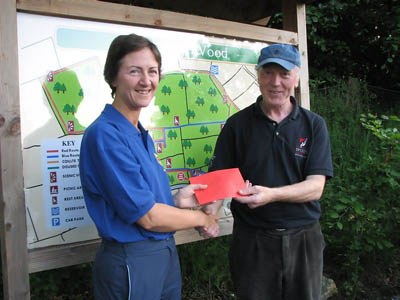
Bishopstown Hillwalking Club recently
made a donation of €500 to SEMRA, the South-East Mountain Rescue
Association during a club walk to Kilbarry Wood near Fermoy. The photo
above shows Sean Cotter of BHC presenting the
money to Maureen O'Brien of SEMRA.
SEMRA provides emergency cover for walkers, hillwalkers, hikers and
tourists on the mountains in the South East of the country. They cover
areas such as the Comeraghs, Knockmealdowns, Galtees, Blackstairs and
the Slieve Blooms.
More information can be obtained about SEMRA on their website...
http://www.semra.ie/
- - - - -

BHC have recently opened an account on the Flickr photo album website.
We have already moved all of the photos from this website to it. In
addition, we have added in excess of 200 extra photos.
There are currently 19 sets of photos. An index of these sets can be
found at
http://www.flickr.com/photos/8799006@N03/sets/
Photos have also been put up for 2 recents walks
Seven Heads Walk on the 10th of June and
Comeragh Walk on the 24th of June
- - - - -
June 2007
Bishopstown Hillwalking Club recently
donated €500 to Kerry Mountain Rescue. The above photo shows Liam
Ryan of Kerry Mountain Rescue Team receiving the €500 from Sean Cotter
of BHC.
The following text was taken from the KMRT website.....
"Sean Cotter of Bishopstown
Orienteering and Hillwalking Club presents a donation of €500.00 to
Liam Ryan of KMRT (above). Bishopstown OHC have been a long-term
supporter of the Team and, as always, we would like to thank them for
their invaluable contribution.
We often say that KMRT members are
the people who go out on the hill to carry out rescues (although we
have been assisted by members of Bishopstown OHC in the past!) but KMRT
is really a broader entity which takes in the hillwalking community as
a whole, and without whose support the Team could not exist. Thank You!
"
Feb 2006
BHC Donations - Bishopstown
Hillwalking Club has donated €500 to the Kerry Mountain Rescue
Association and another €500 to the South East Mountain Rescue
Association. These organizations provide essential rescue coverage for
walkers and climbers in the Munster region. For some idea of the type
of work these groups do, check out the Kerry Mountain Rescue
Association Website and this
article from the Waterford News & Star
4th Dec 2006
Cork Hiker is found safe
and well
"A hiker who went still missing in
mountains at Gougane Barra in west Cork has been found safe and well.
The man who left his home in Blarney
to go hiking early yesterday morning failed to return to his car last
night and was not answering his mobile.He was found earlier today near
Kilgarvan, Co Kerry, - it is understood he had been unable to get
mobile coverage in the area where he was hiking.
Searching had begun at first light
in what were described as atrocious conditions with high winds and
heavy rain.
The search, which included over 20
members of Kerry Mountain Rescue, had been hampered by strong winds and
heavy rain.".........from the RTE
Website.
9th Sept 2006
MCI Statement on the
work of Comhairle na Tuaithe -
"For your information, below is a statement issued this morning by the
MCI to national and local media. Mountaineering Council welcomes
progress on countryside recreation strategy. The Mountaineering Council
of Ireland (MCI), the representative body for hillwalkers and climbers
in Ireland, welcomes the progress made yesterday by Comhairle na
Tuaithe in agreeing a national countryside recreation strategy.
Comhairle na Tuaithe was established in January 2004 by Minister O Cuiv
to address issues relating to access to the countryside, a countryside
code and the development of a national countryside recreation strategy.
Comhairle na Tuaithe is made up of representatives of more than 20
organiations including: the Mountaineering Council of Ireland; the
three main farming organisations; the Irish Sports Council; Coillte,
the Heritage Council and Fáilte Ireland. The group has met
regularly over the last two and a half years. The process also involved
an extensive public consultation process late in 2005.
At yesterday's meeting the IFA decided to dissent from the strategy, in
spite of various efforts to reach a compromise. However the meeting
concluded with agreement between all the other members of Comhairle.
The strategy deals positively with many concerns related to countryside
recreation. While it is not conclusive on every issue, the document
provides signposts as to how, with Government support, countryside
recreation can develop in Ireland for the benefit of all. The strategy
is now being finalised and will go to Minister O Cuiv within the next
couple of weeks for his approval and forwarding to Government. It is
expected that the final strategy will be published in late September."..............from the MCI
New Harvey Map for the Reeks -
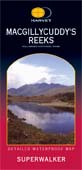
|
Harveys in the UK has just
released a new 1:30,000 map of the Macgillycuddy's Reeks area. The map
is based on a 2006 survey. In addition, it is supposed to have 1:15,000
coverage of some of the areas around Carrauntoohil. It should be
available in most local hillwalking stores.
|
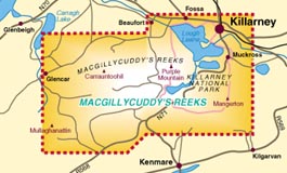
|
Repairs to the 'Devils
Ladder' on
Carrauntoohil - A meeting
was held on the 17th May last
to discuss a proposal to repair the Devil's Ladder. (The Devils Ladder is part of the most
common route up to Carrauntoohil. It is often used people climbing
Ireland's highest peak for the first time. However, it can be
dangerous, especially in wet weather). Full details on what is
proposed can be found on the news section of the MCI website.
5th May 2006 -

|
BHC make €1,000 donation to SEMRA -
Bishopstown Hillwalking Club recently handed over a cheque for €1,000
to Michael Power of SEMRA, the South-Eastern Mountain Rescue
Association. SEMRA is a voluntary group and provides emergency cover
for anyone in difficulty on the mountains in the South-East of Ireland.
They cover a large area, from the Blackstairs Mountains on the Carlow /
Wexford border, the Comeragh, Knockmealdowns and Galtees in Waterford
and Tipperary and up to the Slieve Blooms in the Midlands. The
presentation of the cheque was made during a recent BHC hillwalk in the
Knockmealdown mountains. The above photo shows from left to right,
Paddy Gallagher (Walk leader BHC), Michael Power (SEMRA) and Michael
Carey (Walk leader BHC).
|
Mobile misuse
causes rescue rise in Wales - (From the BBC News
website) - Too many lost hillgoers
call 999 rather than use their own skills and experience to "sort
themselves out", a rescue expert has said. Chris Lloyd, from Ogwen Valley Mountain
Rescue in north Wales, said the misuse of mobile phones was leading to
dozens of needless call-outs for rescue teams. Mr Lloyd has estimated 30% of the calls
to his team could be avoided. Last
weekend, the Ogwen and Llanberis teams had their busiest two days of
the year, with six rescues between them. Both teams also report a higher than
average number of rescues this year.
Ian Henderson, from Llanberis
Mountain Rescue Team, said they were attending more incidents every
year, mainly because of the increasing numbers of people taking up
outdoor sports. He said his
members had been called out 36 times this year, against a total of 70
incidents last year. The
Ogwen team has had 32 call-outs this year. The team was called out a
total of 64 times in 2005. Mr
Lloyd told the BBC News website: "People rely on mobile phones these
days. In days gone by, they would sort themselves out. "Now people just jump to the mobile phone
rather than think about their situation and how to sort themselves out.
"Rather than spending a wet
night out or using some proper navigation and finding their own way
down safely, they just press the button and call us out," he said. "People are depending on them as the
first line of defence. They will go out with no map and no compass and
no whistle - but they have a mobile phone." Mr Lloyd said every time volunteers were
called out on a rescue it cost them money in fuel and often lost work
time. He said team members
had joined mountain rescue to help out fellow mountaineers, but added
it could be "tiresome" when people called them out "without thinking". But Mr Lloyd said mobiles could be
"invaluable" in some situations. "They have reduced call-out time and I
think they do improve the casualty survival," he said.
Instructions on how to treat
injuries are often given by rescue teams over the phone before they
reach the patient. Team
members can also talk people down off the mountain if they become lost
in poor weather or after dark. Mr Henderson estimates mobile phones have
"significantly" reduced call-out time for the Llanberis team. "We can get called out much quicker.
Before, it would take people three or four hours to walk down before we
knew about it." But he
warned carrying a mobile was "no substitute" for climbers and walkers
"being prepared, taking the right equipment and knowing how to use
it"........(from the BBC News Website)
Carrauntoohil Routes - Kerry
Mountain Rescue have recently put 3 routes for Carrauntoohil up on
their website. The routes are : 1. The very common 'Devil's Ladder'
route, 2. The 'Brother O'Shea's Gulley' route and 3. The Caher Route.
They may be of interest to hillwalkers who do not know the area.
Needless to say, beginners or novices should not attempt Carauntoohil
without the company of someone who can navigate properly with a map and
compass.
The link is
http://www.kerrymountainrescue.ie/routes/index.html
OSI Trailmaster
Review

|
One of our members has recently
purchased OSI Trailmaster South and has provided the following comments
:
1. The South DVD does not
include the Galtees, Knockmealdowns, or the Comeraghs.
2. The program at present does
not transfer data accurately to either the Magellan or the Garmin GPSs.
e.g a Carrauntoohil route would be shown in the North sea on the
Magellan or in the Sothern hemisphere on a Garmin - OSI have been
promising a patch to the program since September.
3. The waymark data written in
the waymark report by the program is inaccurate and does not reflect
the accuracy of the waymark positions in the program. Again a patch is
promised by OSI.
It is possible to use a ''work
around'' to transfer to/from a GPS by using Gartrip or other GPS
software to interface with a GPS and then saving the file in GPX
format. This format can be used accurately by Trail Master to
import/export files from/to a disk file.
So the basic advice seems to be that if you plan to interface your GPS
to Trailmaster, you might be better off waiting until all the bugs are
fixed. If however, you don't plan to directly interface it with a GPS
and you don't have the OSI Discovery maps already, then Trailmaster
looks like reasonable value at €99.
Update : July 2006 - The OSI issued a patch which seems to have
corrected the errors in the waypoint report. You still have to export
the trail as a route file and reimport it to get the waypoints listed
if you did not originally individually number them. You can
successfully send a trail to the Magellan GPS from Trailmaster though
the problem with reading from the GPS still exists i.e degrees west are
always treated by Trailmaster as degrees East. There seems to be also a
problem interfacing with the newer Garmins....info from Paddy Gallagher of BHC.
For more information on Trailmaster, look further down this page.
|
 New development at Cronin's
Yard
and in access to Carrauntoohil - One of the most
popular starting points when setting out for Carrauntoohil, Ireland's
highest mountain, is Cronin's yard at the start of the Hag's Glen. A
new development is taking place there which will offer new facilities
to walkers. See below for the text from their website........
New development at Cronin's
Yard
and in access to Carrauntoohil - One of the most
popular starting points when setting out for Carrauntoohil, Ireland's
highest mountain, is Cronin's yard at the start of the Hag's Glen. A
new development is taking place there which will offer new facilities
to walkers. See below for the text from their website........
"For over 200 years Cronin’s Yard has been used as the traditional
starting point for ascents of Ireland’s highest
mountain, Carrauntoohil. Situated at the entrance to the Hag’s Glen at
Mealis, Beaufort, this is the gateway to the MacGillycuddy’s Reeks and
an ideal base from which to explore the surrounding countryside. With
ample car parking
facilities in place and a new development due for opening in March
2006, Cronin’s Yard will offer the walker/climber
a selection of services from packed lunches to a well deserved hot
shower after a long day on Ireland’s premier mountain range.
Cronin’s Yard is also home to the memorials of the 1943 US Skytrain
disaster (the crash site being just above Cronin’s at Cummeenapeasta
Lake).
The facilities on offer include:
• Car parking
• Tea room with open fireplace
• Showers/toilets
• Packed lunches available on request
• Public telephone"
More information can be seen on their new website at http://www.croninsyard.com/
Warning message from the Kerry
Mountain Rescue Team - "ESSENTIAL
SAFETY INFORMATION FOR
CARRAUNTOOHIL - KMRT would like to alert all walkers to an extremely
dangerous situation which exists on Carrauntoohil at present. As many
people know, the summit is surrounded on three sides by very steep
ground, and has always required careful navigation to locate the
correct route in descent, particularly in poor weather. This situation
has been exacerbated in recent times by the fact that a visible ‘false’
track has now developed leading from the summit directly towards
dangerous ground.
Walkers should exercise extreme caution when navigating from the
summit, particularly when visibility is poor. It should be noted that
there are NO safe descent routes anywhere to the N, NE, E or SE of the
summit. All parties should carry a map and compass and should include
at least one competent navigator (ie. capable of consistent accurate
navigation in darkness or white-out conditions) as part of the group.
If you are planning to go walking or climbing over the Christmas
period, be particularly aware that days are short, conditions underfoot
will be very slippery with either ice or water, and your margins for
error are significantly reduced. Ensure that you are adequately
equipped, are only attempting something within your ability and
experience level, and that weather conditions on the day are suitable.
If you are in any doubt it is probably best to leave it until the
summer.
As always, in case of emergency in any mountainous area in Ireland dial
999 or 112 and ask for Mountain Rescue."..............from the KMRT Website.
Italian politician
proposes restoration of ancient pilgrimage route

|
"Italian leader
Romano Prodi says he hopes to revive the medieval route that
took Christian pilgrims from Canterbury to Rome. The Via Francigena
from Britain to Italy dates back to the 10th Century. He said he would
like to see the Italian routes used by pilgrims on foot, bicycle or
horse. The 1,200-mile (1,944 km) Via Francigena, or Way of the Franks,
was founded after the 10th-Century Archbishop of Canterbury, Sigeric,
documented his journey to see the Pope - leaving Canterbury and
crossing France, Switzerland and Italy to Rome. His writings give a
detailed account of his route, which became a key path to one of the
three important pilgrimage centres of the day - the other two being
Jerusalem and Santiago de Compostela in northwestern Spain. Spain's
Camino de Santiago, or Way of St James, from southern France to
Santiago de Compostela, still attracts hundreds of thousands of
pilgrims and tourists each year. Interest in the Via Francigena has
increased since it was designated a cultural route by the Council of
Europe in 1994."............from the
BBC News Web site
|
South-East Mtn rescue
|
The local Mountain
Rescue Team South Eastern Mountain Rescue Association (SEMRA) seeks
new members to start their training in early 2006. We seek
mountaineers or hillwalkers from the South East who have experience in
bad weather conditions and who also have time to commit to training
and Callouts. The average number of Callouts per year is 15.
Training will be provided in all aspects of Mountain Rescue and takes
approximately a year to complete. On successful completion of the
training,
trainee members become full members and are put on the Callout List.
The Team is a 24 hr./day, 365 day/year voluntary "999" emergency
service and is responsible for search & rescue in the mountainous
areas of the south-east of Ireland (Galtee, Comeragh, Knockmealdown and
Blackstairs mountain ranges)
Members are drawn from across the South East from Wexford right over to
Limerick and Mitchelstown.
The Team was formed in 1977 after a plane crash in the Galtee Mountains
and is 1 of 12 Teams in the country, members of the Irish Mountain
Rescue Association (IMRA).www.mountainrescue.ie
If interested in getting more details and an application form please
contact John Foley 087 283 7581 Trainee Laision John Coffey 086
829 4382 Training Officer
|
Comeragh
Access
problems - "Sadly
we have to report that following rejection of plans for an eco-tourism
project by Waterford County Council, the owner of Crottys Lough and its
surrounding lands has closed access to the coum. This is a popular
destination for local strollers as well as hillwalkers. To avoid
aggravating the situation, local clubs are appealing to all walkers to
stay clear of the coum itself, the spur that runs towards Kilclooney
Bridge and all approaches to Crotty’s Lough from the Rathgormack side.".............from the MCI website.
 New mapping product from the Ordnance
Survey of Ireland - Update
New mapping product from the Ordnance
Survey of Ireland - Update
The Ordnance Survey of Ireland have announced that they have
launched
a new DVD based mapping product. They describe it as
follows....."OSi Trail Master is a DVD based PC compatible interactive
mapping tool for the outdoor enthuasist. "
It will have the following features...
Create, print, store and share routes using OSi 1:450,000 and
1:50,000
maps, aerial photography and Digital Terrain Models.
View 3D landscapes and fly-through's using OSi mapping and aerial
photographs.
Import and export route coordinates, waypoints and marks to a GPS
device.
Export routes, maps and aerial photography to a Pocket PC device.
A search and locate tool which uses over 1,800 place and summit names.
Support for multiplle co-ordinates systems, including Irish Grid, ITM
and Latitude/Longtitude.
Dynamic legends and scale bars.
Measurement tools.
Synchronising multiple windows which allow users to simultaneously
view an area of interest with different mapping or aerial photography
backgrounds.
Create Route Profiles, add notes / pictures to routes and much more!
Recommended Retail Price is 99 Euro.
Some screenshots from the product are shown below......
As you can from the map below, the area covered by each product is
shown. 'Trail Master South'
will cover the mountains of West Cork and all the mountains of Kerry.
In the map below, the Eastern edge of the map just includes Mallow and
Macroom. Cork City and towns like Midleton, Bandon and Youghal are not
covered.
The 'Trail Master East'
product covers the Nagles and Ballyhouras in the South, the Comeraghs,
Galtees, Knockmealdowns and Blackstairs in the South-East and on up to
the mountains of Wicklow and South Dublin.
Update..........
According to the OSI web site, 'Trail Master South' and 'Trail Master East' were released on
the 23rd of September 2005.
They also have a 'User Guide' in PDF format for these products.
Here is a selection of some of the points from the User Guide.......
1. Recommended configuration PC
Processor : Pentium III 500 MHz, 512 Mb RAM, 60 Mb free space on hard
drive for the application, 2.5 Gb free space on hard drive for each
data set installed (optional), DVD
drive, Monitor 1024x768, 256 colours, Operating system : Win 98, ME,
NT4 (SP6), 2000 (SP4), XP or higher, COM or USB port for GPS connection
2. The OSi Trail master
application is protected by a licence system granted per region (East,
West, North, South) for personal use only, for one PC.
To use the application you must register your licence. In return you
will receive a licence file to install on your PC.
The licence is granted on the basis of two pieces of information: - The
unique identifier of your PC - The serial number found on your OSi
Trail Master box.
Caution ! The licence file you get from our website is valid for one PC
only. Make sure to register the right PC !
3. The map data and software
supplied on the DVD includes:
- OSi 1/450 000 national map.
- OSi 1/50 000 map (selected coverage).
- OSi 10 meter Digital Terrain Model data (selected coverage).
- OSi aerial photographs (“orthophotos”) (selected coverage).
- OSi database of placenames.
4. Data Currency
- The OSi 1:450,000 base map was complied and published in 2003.
- The OSi 1:50,000 base maps were compiled from aerial photography and
published during 1999 – 2004.
- The OSi 1:40,000 aerial photography was captured during the summer of
2000.
5. Every application includes
an all Ireland map at 1:450,000 scale (excluding Northern Ireland).
Each region (North, South, East, West) has additional map data
available for that region, which includes1:50,000 Discovery maps and
1:40,000 aerial photographs.
6. GPS
OSi Trail Master is equipped with an interface to the GARMIN and
Magellan GPS receivers.
Your OSi Trail Master release has been successfully tested with the
following GPS models:
ETREX GPSMap60C, ETREX Summit GPSMap 60CS, ETREX Legend GSPMap76C,
ETREX Venture GSPMap76C, ETREX Vista ETREX Legend C, GPS76 ETREX Vista
C, EMAP Forunner301, GPS V GPS60, Geko 201, Geko 301, Foretrex101,
Foretrex201, Forunner201, GPSMap76, GPSMap76S, Garmin GPS72, Magellan
Meridian Gold, Garmin Quest
You can download the full User Guide (1.32 MB / About 5 mins with a 56k
modem) at http://www.osi.ie/mapping/other/OSI_Trailmaster_UserGuide.pdf
7th Sept 2005
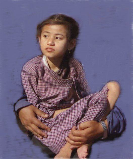
Charity Swim - Hillwalkers Swim for Laxmi.
The fund,set up by a group of Cork Hillwalkers, to help build a house
for
an unfortunate Nepali child, stricken with Cerebral Palsy and Epilepsy
was boosted recently by a novel Fundraiser.
Readers will remember Laxmi and how the walkers adopted the family.
A target of 20,000Euro was set to build a house in Kathmandu, for the
family
of Laxmi and her parents.
Marie Foster Scannell proposed the Galtee Lakes Swim as her
contribution
to the Fundraising. A set of Four novelty swimsuits were
fashioned
by Marie to be used in each of the four Galtee lakes. The suits
were
The Polka Dot Bikinni, The Beakie, The Swan Lake ensemble and her
finale
The Mermaid The preparation of the suits brought its own problem but
Marie
is Marie and all was in order for Sunday August 21st, except a little
item
called Weather. Hillwalkers are tough and weather is only to be
contended
with so the large group assembled at Clydagh Bridge and walked to Lake
Curra high in the bosom of Galtee Mor.
Ellie Mc Donald led the Bishopstown walkers to the lake and Marie duly
donned firstly her Bikinni followed by the Beakie then the Swan Lake
and
finally the Mermaid. Marie assured the onlookers that the water
was
beautiful but the group preferred the elements to the choppy lake
waters,
so Marie was left as she deserved ,Solo.
Pakie Fitzes, in Mitchelstown, was the next venue where the flagging
spirits were revitalised by injections of food and liquids .
A raffle of a Dinner for Two, kindly donated by the Kingsley Hotel
management, was a highlight and when the ticket of Phil Twomey, present
at the time, was drawn out of the hat celebrations reached crescendo.
The event boosted the fund by nearly 2,000 Euro thanks to the
sposorship
of many friends of the walkers. A timely boost in the wake of the
purchase
of the site for Laxmi,s house.
Marie deserves the thanks of the organisers for her trojan work and
her braving of the elements at the Galtee Lakes. A great day was
had by all.
Laxmi will be pleased.
Thank you Marie and Bishopstown Hillwalkers.
27th July 2005
New
Walking Proposals from the Irish Farmers Association -
"IFA President John Dillon has said that a real
opportunity exists to resolve the difficulties surrounding recreational
use of the countryside through the implementation of a new and
innovative
scheme to promote managed walkways. Mr. Dillon was speaking at the
launch
of an IFA initiative for a Countryside Walkways Management Scheme, the
aim of which is to enhance the tourism potential of rural regions and
to
boost their economic development. "The scheme will ensure that farmers
and landowners can play an important role in realising the natural
assets
of the countryside through agreed walks in a new Countryside Management
Scheme". The IFA President noted that there has been a decline in
walking
tourism over the last number of years. "This trend can be reversed
through
a scheme that would initially cost around €6m, but which would increase
over time to involve 5,000 farmers at a cost of €15m. Up to 2,000
km of walks could be created, which is equivalent to three times the
distance
from Malin Head to Mizen Head". Mr Dillon said the Countryside
Management
Scheme was the result of widespread consultation within IFA and would
involve
both annual and capital payments to cover ongoing costs where
investment
was required to create walks. "It is important that the Government
through
local authority insurance funds fully indemnifies landowners against
any
claims from people using these walks". Mr Dillon welcomed the support
of
the Mountaineering Council of Ireland for the IFA initiative. A
representative
from the Mountaineering Council attended today's launch. Mr Dillon
called
on the Government to support this incentive which encourages managed
use
of the countryside while at the same time protecting the legitimate
interests
and the rights of landowners.".................from the IFA Web Site
"The Irish Farmers' Association has issued proposals which it hopes
will bring an end to the long-running confrontation over the use of
farmland
by recreational walkers. IFA leader John Dillon said the initiative
encourages
managed use of the countryside as well as protecting the rights of
landowners.
The Mountaineering Council has welcomed the proposals.
For several years many farmers have been reluctant to allow leisure
walkers onto their property. The IFA today unveiled a list of proposals
to help bring an end to the difficulty. It is proposing a Countryside
Walkways
Management Scheme to help boost the tourism potential of rural areas.
The association wants to reverse the decline in walking tourism by
involving up to 5,000 farmers in creating 2,000km of walks all over the
country. The IFA is hoping that the Government will provide the €6
million needed to launch the initiative.
It also wants local authorities to indemnify landowners against any
insurance claims involving walkers on their property.
It is proposed that Fáilte Ireland would operate the scheme.
Farmers would get an annual payment of €1,000 plus €5 per metre,
and the scheme would eventually cost about €15 million annually.
It is thought it will take several months before all parties agree
on a deal"..................from the RTE News
Web Site
Comment on the IFA proposal by
the Mountaineering Council of Ireland...
"The Countryside Walkways Initiative, announced by
the IFA on 27th July, is not just another “money for access”
proposal as some media coverage has suggested. In exchange for an
annual
payment, participating farmers would carry out annual maintenance and
(though
this is not quite clear) bear at least part of the capital cost of
creating
a route. This is a
break-through
and is the reason for the MCI’s guarded welcome for the proposal.
The IFA proposal is to set up a Countryside Walkways Management Scheme.
The scheme would be administered by Failte Ireland who would
co-ordinate
the creation of a network of new walkways through local development
associations.
The proposal could involve 5,000 landowners in developing and
maintaining
up to 2,000km of linear and looped walks. It is proposed that this
would
initially be a 5-year scheme. The proposal also assumes that private
landowners
will be indemnified against claims, as is standard on the National
Network
of Waymarked Ways.
The payments suggested (€1,000 per farm plus €5 per metre
of walkway) are undeniably very high; but no doubt the IFA is expecting
to have to haggle. To ensure wide distribution of funds it might be
necessary
to cap the amount that an individual landowner could draw down. The MCI
believes that any walkways developed under the proposed scheme should
be
approved by the National Waymarked Ways Advisory Committee. The scheme
may not deliver all that many new walks, as farmers who currently have
waymarked routes across their land could apply for this scheme on the
basis
of doing maintenance work which is currently carried out by local
authorities
or local committees.
The proposal is only concerned with the provision of waymarked walks.
This would probably satisfy Fáilte
Ireland’s
desire to provide walks for tourists, and meet the needs of the many
Irish
people who want to walk for a few hours on paths. The
proposal doesn’t provide access for the majority of MCI members, who
want
access paths from the road to the open hillside, but presumably the
scheme
could be tailored to include such paths. The proposal makes reference
to
commonage; the administration of such a scheme on commonage is sure to
be tedious and complex. Aside from that, there would be safety issues
with
the creation of waymarked walks on high, open ground.
There are many others recreational users for whom the proposal does
nothing – rock-climbers, birdwatchers, mountain bikers, fishermen,
canoeists,
and hang-gliders, in fact anyone who wants to get countryside access
where
there isn’t a trail, which means everywhere that isn’t considered
popular
enough to justify the expenditure on a trail.
This is a long list of objections, nevertheless the MCI congratulates
the IFA for producing the first positive solution to current access
problems
by a landowner’s organisation.
It will take much argument in Comhairle na Tuaithe and elsewhere before
a version of this proposal which is acceptable to all parties is
achieved,
but we now have a basis on which to start the discussion. It is
essential
that these discussions take into consideration the needs of all
countryside
users, not just walkers.MCI, 4/8/05."..........from
the MCI Website
7th June 2005
 |
New Map for Brandon - The
Ordance Survey
of Ireland have recently published a new 1:25,000 map of the area
around
Mount Brandon in the Dingle peninsula in Kerry. Last year, the OSI
published
a 1:25,000 map of the Macgillycuddy Reeks in Kerry. Note that these
maps
are at twice the scale of the more usual 'Discovery' maps which are
1:50,000 |
9th April 2005
Teach Laxmi.
On behalf of the committee of teach Laxmi I wish to thank all those who
helped out and took part in the recent Quiz night. In particular the
quiz
Master Billy Joyce, Mick Muphy and Theresa and Kate who prepared the
questions.
Helen and her team of scrutineers and all who helped on the night. The
number of prizes for the raffle was most impressive and a
special word of thanks to all who donated same.
We brought in over eur 1600 euro and the total is now well on track to
reach our objective. If there is any money out there collected for the
walk or if you intended to make a donation and never got round to it
then
send it in now and be part of this worthy and successful venture. Thank
you again, Noel Power. Chairperson.
Teach Laxmi Fundraiser. "The
organisers
wish to thank all who contributed to the success of last week-end's
fundraiser.
Both walks were a great success and the craic in the Abbey was mighty.
All who took part , Liam, Gabrielle, Cato and Louis and the choir
warmed the hearts of their listeners. Hopefully Liam was in
equally
good voice on Thursday night.
The organisers are now anxious to have the sponsorship cards and any
monies, returned as soon as possible. Best to lodge the money directly
to Teach Fundraising, AIB Bank Killarney A/C no..31893054 Sort code 93
63 32.
Lodgement can be made at any AIB branch. Please put your name
in narrative section and add the word" card." Helen, Billy and
Noel
will be glad to collect from people who prefer the personal touch.We
need
the cards returned even if blank"....Billy.
Check out our web site:- http://homepage.eircom.net/~bishopstownohc/laxmi.html
"
11th March 2005
 Slide
Show and Talk raises over €1,800- "I would like to thank
very much the great support given to our slide show on our recent Trek
in Nepal and particularly the great support for our collection for
providing
a house for Laxmi a Nepali child with Cerebral Palsy. The collection
taken
up came to eur 1,835 which was fantastic and this brings the total
collected
to date very close to eur 5000. This is 25% of out target and it is
very
heartening to us at this early stage.
Slide
Show and Talk raises over €1,800- "I would like to thank
very much the great support given to our slide show on our recent Trek
in Nepal and particularly the great support for our collection for
providing
a house for Laxmi a Nepali child with Cerebral Palsy. The collection
taken
up came to eur 1,835 which was fantastic and this brings the total
collected
to date very close to eur 5000. This is 25% of out target and it is
very
heartening to us at this early stage.
Contributions from any members who didn't get around to it yet should
be lodged to account Teach Fund raising, AIB, 25 main street Killarney
account number 31893054 and sort code 93 63 32. Or send a cheque
payable
to teach fund raising to me or any committee member.
We are having a charity walk for all on Easter Sunday. I will lead
a B walk to Carrauntoohill while Billy Joyce and Helen Smith will lead
a C walk in the Cappagh Glen. Sponsorship cards are available. We have
also organized a table Quiz for Highfield Rugby Club for Friday April
15.
Thanks again for your great support for our worthy cause.
.......Regard's,
Noel Power."
Find out more about this worthy cause by going to this web page - http://homepage.eircom.net/~bishopstownohc/laxmi.html
Black
Valley mobile phone coverage - "How
to
provide a mobile phone service in the remote Black Valley, deep in the
Kerry moutains, is a problem facing residents. The spectacular valley
only
got electricity in the late Seventies, after a long campaign. Now, the
problem is with mobile phone reception. Kerry County Council is making
requests to mobile phone operators to ensure the valley people get a
service.
Cllr Danny Healy-Rae said that as well as assiting people in the
valley,
a proper service would also benefit climbers that get into trouble"............from
the Cork Evening Echo.
SUPREME
COURT JUDGMENT - "The Supreme Court
delivered
its decision this morning (Friday 21st January 2005) on the Rosnowlagh
cliff fall case and we're (MCI) relieved to report that the High Court
judgment of February 2002 was set aside. This should ease landowners'
concerns
about being liable should recreational users be injured while on their
property. A news release was issued this afternoon by the MCI
(available
on www.mountaineering.ie).
Supreme Court judgment on cliff fall case The
Mountaineering Council of Ireland (MCI) notes today’s Supreme Court
judgment
in the Rosnowlagh cliff fall case. On this basis the occupiers of land
are entitled to assume that persons engaged in outdoor activities have
a “common sense” knowledge of the associated dangers and risks and will
take appropriate measures for their own safety. It has always been the
MCI’s policy that participants in outdoor recreation should accept the
risks inherent in these activities and be responsible for their own
actions
and involvement.
This judgment should be a huge relief to the
farming
community and other landowners who have expressed concern about their
potential
liability for injuries sustained by recreational users on their
property.
This concern has been stifling the Irish tourism industry and
contributing
to restrictions on the ability of Irish people to pursue healthy
outdoor
recreation. We now look forward to working with the other members of
Comhairle
na Tuaithe to embrace the potential of countryside recreation in
Ireland, to the benefit of the whole population
and visitors to this country.".......from the Mountaineering Council
of Ireland.
8th Jan 2005 -
Missing
hill walker is found safe and well - "16
December. The Limerick woman who was missing in the Galtee Mountains
overnight
has been found alive and well after 18 hours. Mother-of-three Rita
Hickey
from Oola in the west of the county went missing yesterday afternoon
when
she was walking in the mountains with a male companion. He raised the
alarm
and searches for her went on overnight and this morning. At around 11am
Rita was found in a wooded area on the Mitchelstown side of the Galtee
Mountains, several miles from where she went missing. Rita had
sheltered
there overnight before she was found by an elderly man who knows the
area
well. She was said to have been cold, wet and tired when found but not
seriously injured. Mountain and cliff rescue teams as well as Civil
Defence
Units, gardaí and a coastguard helicopter took part in the
search."....................from
the RTE News Web site
Women survives night in the Galtees -"Miracle
women Rita Hickey said yesterday she survived a night lost in the
Galtee
Mountains with the help of a prayer, and a Mars bar. Rita, 46, from
Oola,
Co.Limerick, was rescued after she stumbled out of dense forestry near
Mitchelstown. Rita, who runs a betting shop in Oola, slept under a tree
after walking for five hours in total darkness. Hundreds of civil
defense
and army personnel and mountain rescue teams joined Gardai and locals
in
a night long search. She and fellow Galtee Walking Club member, Danny
Bailey
from Tipperary, were on Galtee Mor when they got seperated. She
recalled
"It was going on for five o'clock and getting dark. Danny was ahead
of me and he kept saying to me 'Rita, hurry on, hurry on'. I kept
telling
him that I was well able to keep up with him and told him to carry on.
We were between two lakes at the time and he disappeared. I kept
shouting
'Danny, Danny'. There was no reply."
It was now dark, and Rita did not know where she was on the mountain.
"I sat down on a rock and said to myself "either stay here and
freeze
or keep walking." I kept walking for hours and hours in total darkness
through very rough mountainside. I had to cross through gullies and at
one stage I had to go accross a flooded stream. After about 5 hours I
got
down into a forest and went to sleep under a tree for about two hours
and
woke up at around 5:30 am."
Rita said she saw helicopters hovering over the forest but was unable
to catch their attention. After dawn, she trekked through the forest,
eventually
finding a main road near Mitchelstown at around 10:30 am yesterday. "A
local man, Joe Boyle, pulled up in his car and brought me to Tipperary"
said Rita.".............................from the Irish Examiner
newspaper.
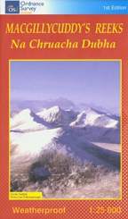 |
New Reeks Map - The Ordance
Survey of
Ireland have recently published a new 1:25,000 map of the Macgillycuddy
Reeks in Kerry. It can be bought directly online from their web
site
or in any good hillwalking store. |
17th Dec 2004

New
Kerry Mountain Rescue Headquaters -"We are delighted to
announce
that Minister for Sport John O'Donoghue will officially open the new
KMRT
headquarters on September 9th. The new HQ represents one of our most
ambitious
projects to date, and involved the extention of our main equipment
store
at Killarney Garda Station to include garage facilities, office space,
an extended equipment storage area, equipment washing area and toilet
facilities.
This facility represents a working partnership between the State
(in the form of the Department of Justice, who kindly made land
available
within the grounds of Killarney Garda Station) working closely with a
voluntary
organisation.
The new facility will serve as the Team's HQ for many years to come
and is a major step forward for the Team." - Source - KMRT Web
Site
20th December 2003 -
Fundraising
Quiz for Mountain Rescue Teams - On Friday,
the 7th of November, Bishopstown Hillwalking Club held a Table Quiz
Night
to raise funds for the Kerry Mountain Rescue Team and other Rescue
Teams.
A very special thanks to Mick Murphy for again organising a very
successful
quiz night to raise funds for the Kerry Mountain Rescue Association.
Thanks
to our MC Billy, DJ John, and the team of Helen, Kate, Theresa, Karen,
Liam, Michael and others.
Thanks to all who supplied sponsorship prizes.
Thanks to our main sponsors as follows for the Quiz night
MAHERS SPORTS
UNION CHANDLERY / HILLWALKERS
THE GREAT OUTDOODS
TENTS & LEISURE
KATE KEARNEY'S COTTAGE (Mary Coffey)
Raised on the night was just over €2,000.
This added to the €2,500 from the swim, and the €1,000 from
BHC gives a grand total of over €5,500 for the year 2003 for
KMRA.
Another €500 from BHC will be given to the South Eastern
Mountain Rescue Association for the year 2003.
Funds raised by BHC in previous years are as follows : 1998 -
£634.87,
1999 - £1,015.79, 2000 - £1,650.66, 2001 - £2,745.80,
2002 - €3,602.15 (plus €500 to South East Mountain Rescue Association)
 Back
to the Bishopstown Hillwalking Club Main Page
Back
to the Bishopstown Hillwalking Club Main Page


