
 The idea of counties was first introduced to Ireland following the Anglo-Norman invasion in the twelfth century. At that time 12 counties were defined in Leinster and Munster. From that time until the mid sixteenth century county borders were not well defined reflecting the weakness of English control during that period. During the reign of Elizabeth 1 the counties o f, Longford, Clare, Galway, Sligo, Mayo, Roscommon, Leitrim, Armagh, Monaghan (1585), Tyrone, Derry **, Donegal, Fermanagh (1585), and Cavan were formed. But still the county borders were not very clearly set out. However, improvements in mapping gradually resulted in the counties as we know them today. Wicklow, surveyed and destinguished into a county in 1606, was the last county to be formed. See Below
Counties were set up as areas for local government (County Councils). They still exist for this purpose in the Republic of Ireland except for Dublin which is divided into four and Tipperary which is divided in two. Northern Ireland is divided into administrative districts. Nevertheless, people still largely identify themselves by their native county.
Source: mostly Tudor and Stuart Ireland - Margaret McCurtain
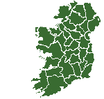
Top of Page | Listed by name in Irish | See the Map | County Page
| Antrim | Aontroim | ? |
| Armagh | Árd Mhacha | Macha's Hill |
| Carlow | Ceatharlach | four lakes |
| Cavan | Cabhán | a hollow |
| Clare | Clár | a level piece of land |
| Cork | Corcaigh | a marsh |
| Derry ** | Doire | an oakwood |
| Donegal | Dún na nGall | fortress of the foreigners (Vikings) |
| Down | Dún | a fortress |
| Dublin * | Baile Átha Cliath | black pool |
| Fermanagh | Fir Manach | the men (tribe) of Manach |
| Galway | Gaillimh | ? |
| Kerry | Ciarraí | the descendants of (tribe) of Ciar |
| Kildare | Cill Dara | church of the oak |
| Kilkenny | Cill Chainnigh | church of St. Canice |
| Laois | Laois | Lughaidh Laeighseach a chieftain |
| Leitrim | Liatroim | grey ridge |
| Limerick | Luimneach | a barren spot of land |
| Longford | Longfort | a castle or encampment |
| Louth | Lú | ? |
| Mayo | Maigh Eo | the plain of yews |
| Meath | Mí | middle (province) |
| Monaghan | Muineacháin | a place of little hills |
| Offaly | Ua Fáilghe | the descendants of (tribe) of Fáilghe |
| Roscommon | Ros Comán | St. Coman's wood |
| Sligo | Sligeach | shelly river |
| Tipperary | Tiobraid Arainn | the well of Ara |
| Tyrone | Tír Eoghain | the territory of Eoghan |
| Waterford * | Port Lairge | Vadrefiord (Viking) |
| Westmeath | Iarmhí | western middle (province) |
| Wexford * | Loch Garman | weis fiord (Viking) |
| Wicklow * | Cill Mhantáin | viking gelo (Viking) |
* these cases are not an English pronunciation of the name in Irish.
** Derry or Londonderry. Both names are in use.
Listed by name in English | Top of Page | See the Map | County Page
| Aontroim | Antrim | ? |
| Árd Mhacha | Armagh | Macha's Hill |
| Baile Átha Cliath | Dublin | town of the ford of the hurdles |
| Cabhán | Cavan | a hollow |
| Ceatharlach | Carlow | four lakes |
| Ciarraí | Kerry | the descendants of (tribe) of Ciar |
| Cill Chainnigh | Kilkenny | church of St. Canice |
| Cill Dara | Kildare | church of the oak |
| Cill Mhantáin | Wicklow | St. Mantan's church |
| Clár | Clare | a level piece of land |
| Corcaigh | Cork | a marsh |
| Doire | Derry ** | an oakwood |
| Dún na nGall | Donegal | fortress of the foreigners (Vikings) |
| Dún | Down | a fortress |
| Fir Manach | Fermanagh | the men (tribe) of Manach |
| Gaillimh | Galway | ? |
| Iarmhí | Westmeath | western middle (province) |
| Laois | Laois | Lughaidh Laeighseach a chieftain |
| Liatroim | Leitrim | grey ridge |
| Loch Garman | Wexford | Garman's lake |
| Longfort | Longford | a castle or encampment |
| Lú | Louth | ? |
| Luimneach | Limerick | a barren spot of land |
| Maigh Eo | Mayo | the plain of yews |
| Mí | Meath | middle (province) |
| Muineacháin | Monaghan | a place of little hills |
| Port Lairge | Waterford | ? |
| Ros Comán | Roscommon | St. Coman's wood |
| Sligeach | Sligo | shelly river |
| Tiobraid Arainn | Tipperary | the well of Ara |
| Tír Eoghain | Tyrone | the territory of Eoghan |
| Ua Fáilghe | Offaly | the descendants of (tribe) of Fáilghe |
** Derry or Londonderry. Both names are in use.
The sources for the meanings of county names were either
The Way that I Went - Robert Lloyd Praegar or
Irish Local Names explained - P.W. Joyce
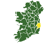 The county of Wicklow has its origins in the early 1500s. In an indenture made at Dublin on 4 July, 1542 Thady O'Birne, described as captain of his nation, and other nobles inhabiting 'a certain country between the Wynde Gates and the town of Arklowe in the county of Dublin' petitioned the King that their country might be erected by authority of parliament into a county, with the name of the county of Wickow, so that henceforth they might hold their lands from the crown and a sheriff and other officers might be constituted there. The lord deputy and council ratified their submission provided the at the King should accept it within a year, but nothing was to come of this proposal. In the late 1540s instead, three administrative zones were created in what is now the county, corresponding to the areas inhabited by the three septs of the O'Byrnes, O'Tooles and Kavanaghs, each ruled by an english captain from a convenient fort.
In 1578 a royal commission issued for the areas south and east of Dublin to be bounded out into a shire, to be named and called the county of wicklow, Sir William Drury, the Lord Justice, defined the boundaries of the county but 'findinge that ther were not sufficient, and (fewer) gent, to be shriffes nor freeholders to make a jury for her Majestie' the matter was let drop.
It was thus not until 1605 that Sir Arthur Chichester as lord deputy completed the work of a generation earlier by having the county of the Birnes and Tooles surveyed and distinguished into a county. The shiring of Wicklow was finally completed only in the folowing yaer and, as Litton Falkiner points out, the county nearest he metropolis was the last to brought effectively within the scope of the English government.
Source: Wicklow - History and Society - From Grand Jury to County Council by Brian Donnelly.