
MAPS OF VALENCIA PARISH
Location Map of Valencia Parish
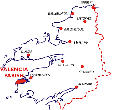
" This parish lying to the north of the parish of Killemlagh,
and to the west of that of Caher is an island."
[From The Antiquities of County Kerry by John O'Donovan (1841)]
Townlands of Valencia Parish
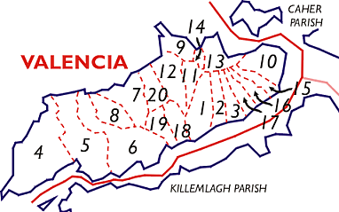
| Number |
Townland |
| 1 | Ballyhearny East |
| 2 | Ballyhearny West |
| 3 | Ballymanagh |
| 4 | Bray |
| 5 | Coarha Beg |
| 6 | Coarha More |
| 7 | Cool East |
| 8 | Cool West |
| 9 | Dohilla |
| 10 | Farranreagh |
| 11 | Feaghmaan East |
| 12 | Feaghmaan West |
| 13 | Glanleam |
| 14 | Gortgower |
| 15 | Kilbeg East |
| 16 | Kilbeg West |
| 17 | Laharan |
| 18 | Tinnies Lower, East |
| 19 | Tinnies Lower, West |
| 20 | Tinnies Upper |
[Last updated: 12-Jul-2004 09:13 PM - Laurence Jones]