| Brief Description This is a very easy walk, it involves no climbing, and is an ideal route to choose if you have no mountaineering experience. This route is of great historical interest and is a very pleasant for both experienced walkers and the not-so-experienced. It is not really necessary to bring a map, but if you have one bring it along.
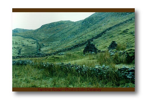
Route Description Parking is on the Quay at L770649. From here walk less than 100 meters back from the hostel taking the first left turn onto a grassy road near a house. This leads you to a track with a high wall on your left, to the shore of Killary Harbour. Keep to the track along the shore until you reach the ruin beyond a tiny bridge. There are a number of abandoned ruins from the time of the great famine along this route. There are also spectacular views of Killary Harbour and Maol Reidh along this track. You have walked approximately 4 km by now. You can continue on for as long as you want, but you have seen the best views at this point. Return back to the quay along the same route. Cheap accommodation is available at the Little Killary Adventure Centre and the Hostel on the Quay. May I recommend Veldon's pub in Letterfrack for refreshments. I recommend the local lamb cutlets in particular! The Great Famine - Some interesting LinksHistory of
the Irish famine |