| Brief Description This is an interesting walk, leading you into the heart of the Maamturk mountains with spectacular views onto the Inagh valley to the West and Gleann Glaise and the Maam Valley to the East. The ascent is gentle, however the decent is quite steep, over a grassy slope, which can be very slippy when wet.
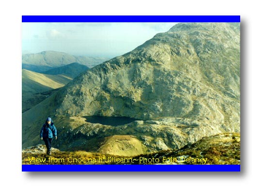
Route Description Access to this area is along the main road between An Maam and Leanaun. Take the turn at Na Braonain at L932552. This boithrin (small road) crosses Joyce's river, and shortly afterwards turns right into Glean Glaise (Glenglosh). Parking is along the roadside 4 km after the turn at L884554. The ascent from the parking place starts along a newly constructed forestry road. ( How the forestry service got away with the destruction of this mountain, beats me!). Follow this road almost to the end and turn right towards the col, known as Mamochoige. From the coll continue Eastwards towards the summit of Cnoc na h'Uilleann at L870537 (Knocknahillon). There is a beautiful view of the corrie lake Loc Mam Ochoige from here. The summit itself commands spectacular views over the Maamturks on the East and the Twelve Bens further to the West. From the summit continue along the ridge northwards for 1 km and
then North Westwards for 1 km past Barrlugrevagh and onto the East ridge of Binn
Bhriochain (Letterbrechaun). The summit of Binn Bhriochain is about 1/2 km off our route
to the East. The decent down along the East ridge of Binn Bhriochain begins with a gentle
gradient but gets considerably steeper after 1 km. This final decent over very fine grass
(caused by sheep grazing) can be very slippy when wet, so beware! |