|
Galtees |
Walk Grade Moderately hard, can be done in 4hours at a brisk pace. Access Leaving Michelstown in a northerly direction keep to your right and take the N8 in the direction of Cahir.Pass through Kilbeheny and shortly after leaving Skeheenaranky take a turning on your left GR(90.66 17.57) which has a sign post for Galtymore. As viewed on the map drive straight along this road for about 3.5km until it ends in a small car park GR(89.30 20.35), if the area is busy it may be necessary to park on the side of the road before you reach the car park. Walk Features Galtymore at 919m is one of Irelands highest mountains. Being over 3000ft it is one of the Irish Munros, where it is ranked number fourteen on the list of the fourteen Irish Munros. On the summit ridge there is a cairn and a white iron Celtic cross overlooking the Glen of Aherlow.The approach to the mountain from the south side on the black road provides a panoramic vista of the mountain landscape. The gradual nature of the approach makes the ascent relatively straightforward for a climb to 919m. This area is covered in OS Discovery Series Map No 74. Walk Details From the car park continue along the same road passing through a gate in a northerly direction. Shortly after the first gate you must pass through a second gate as you proceed along the stony Black Road initially in a northwesterly direction. After about 0.75km you will be walking in a northerly direction as you continue to climb. You will see Knockeenatoung ahead slightly to your right. The road will take you around the western side of Knockeenatoung without climbing it. To your left you will begin to see really good views of the Galty Mountains with Galtymore ahead to your left. After passing Knockeenatoung on your right the black road will take you towards another peak ahead at 657m GR(89.23 23.26). Leave the black road at GR(89.18 22.87) where it veers to the right and climb 657m GR(89.23 23.26) straight ahead. You can now see both Galtymore and Galtybeg ahead. You need to aim for the coll between Galtymore and Galtybeg, but first you will walk towards Galtybeg and then veer left for the coll between the two mountains. In misty or windy conditions it is very important to remember that the northern side of the coll has a precipitous drop overlooking Lough Dineen, it may therefore be necessary to always keep well to your left as you climb Galtymore. The summit of Galtymore is usually very windy and in winter months is frequently covered in snow. However this can provide a good background for photographs with the white Celtic cross. You may want to take a break here but Galtybeg summit usually offers better shelter from prevailing wind conditions. As you leave Galtymore you need to retrace your path coming up. Also if conditions are windy or misty always keep to your right going down. When you reach the col between the two mountains you can now begin the much easier ascent to Galtybeg 799m. From the summit of Galtbeg you must descend in a southerly direction towards the peak at 657m GR(89.23 23.26) which is straight ahead. As you cross this peak a view of the Black Road will unfold before you giving you the return path to retrace your steps to the car park. You should be hitting the Black Road at about GR(89.17 22.85). A fairly minor extension to the walk can be made by summiting Knockeenatoung 601m on the way back. To do this veer off the road to the left at about GR(89.31 22.28) and climb Knockeenatoung. From the summit come down in a southwesterly direction to rejoin the road at about GR(89.17 21.50). |
Click on any Image to Enlarge it. |
|
|
|
|
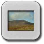
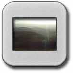
Galtymore from Black Road |
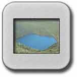
Lough Dineen |
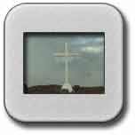
Galtymore Celtic Cross |
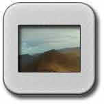
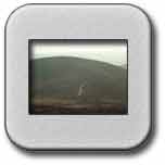
Galtybeg |
 |
 |
 |
View of Return from Galtybeg |
Return View of Black Road |
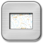
Route of Walk |
![]()