

|
Knockmealdowns - Sugerloaf Hill, Knockmealdown
|
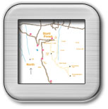
Walk Grade Moderately hard walk, requires about 4.5hours. Access On the Lismore Clogheen Road R668, proceed to an area known as the Vee Gap, which is about 5.5km from Clogheen. Park on the opposite side of the road from the Grubb monument, which is about 150m on the Lismore side of the Vee hairpin GR(04.01 11.80). There are car parks nearby but this point represents the start of the walk. Walk Features The Knockmealdown range of mountains for a good part straddle the Tipperary Waterford border. The highest peak is Knockmealdown (794m) with other peaks Knockshanahullion(652m), Sugarloaf Hill (663m), Knocknagnauv (655m ),Knocknafallia(668m ), Knockmeal (560m ). This walk starts at the Grubb Monument at The Vee Gap and is a circuit comprising of Sugarloaf Hill, Knockmealdown, Knockshane and Glenmoylan Valley. In the early summer months the lower areas of the hills are lit up with rhododendron blooms. This area is covered in OS Discovery Series Map No 74. Walk Details Proceed directly up following a path towards the Grubb monument GR(04.00 11.31). From this point follow the track leading directly up to the top of Sugarloaf Hill. This can be a strenuous climb for some people as you are climbing immediately from the start of the walk without a warm up period. The route to the top is more or less in a straight line and there are clear tracks taking you up. The bearing from the start of the walk to the top of Sugarloaf hill is exactly due South 180deg. As you approach the top of the hill you will see a lot of boulders and then a large stone cairn marking the initial peak of the hill. This peak GR(03.93 10.61) 623m would be a good place for a break, the highest point on the Sugarloaf being a little further on at GR(03.97 10.49) 663m and marked by a much smaller cairn. From this point you can clearly see the path ahead to the top of Knockmealdown. On the OS map 74 the way ahead follows the dotted county boundary line. If visibility is poor follow the track along the side of the small wall. The path will take you down from the top of the Sugarloaf to a coll between the two mountains. At GR(04.405 09.706) there is a track to the left, which you will take on your return path. It is now simply a matter of following the track up to the top of Knockmealdown GR( 05.79 08.41) 794m, which is marked by a trig point. From the top of Knockmealdown you can see the remainder of the Knockmealdown mountain range to the east in the distance, and Knockshane immediately to the north. From the top of Knockmealdown return along the path you came for about 300m and then go north to the top of Knockshane GR(05.804 09.32) 769m. At this point you will get a good view of the vale below to the north. From here you will return in a westerly direction to pick up the track again, which you came up on. Now continue on down this track to the path to your right at GR(04.405 09.705). At this point you have the option returning the way you came over Sugarloaf hill or turning to the right into Glenmoylan valley. For the latter option continue on down the track towards the valley below. Do not take any tracks to the left but continue down, you will need to drop about 120m in height. When you get further down into the valley you will come to a grassy area with a fence to your left. Cross this fence and you will pick up a path which will take you along the side of Glenmoylan valley. As you walk along the valley you can hear a stream to your right and see the conifer trees on the other side of the stream. You will need to walk in a northerly direction on these stony tracks for nearly 2km. When you get near to the Vee you will see a signpost for 'St Declan's Way'. Take this track and then follow the yellow man signposts to bring you up and out onto the road at the Vee hairpin. |
Click on an Image to Enlarge it. |
 |
 |
 |
 |
Initial Sugarloaf Peak |
Looking across the Gap from Sugarloaf |
Climb to Knockmealdown taken from Knockmealdown peak |
Knockmealdown Range to the East from peak |
 |
Route of Walk |