

|
Mangerton
|
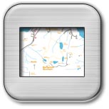
Walk Grade Hard walk with some low level scrambling, can be done in about 5hours. Access From Killarney take N71 in direction of Kenmare. At about 4km from Killarney you will pass Muckross on your right. Continue on as far as Molly Darcy's Pub on your left and take the first turning on the left past Molly Darcy's. This is a very sharp left immediately past Molly Darcys.Continue down this road for about 1.5km and take a right turn where you can see a signpost marked Mangerton.This road will lead you to Gortagullane where there is a small parking area for access to Mangerton GR(98.39 84.92). Walk Features Mangerton, which lies partially within the environs of Killarney National Park, is the only mountain, which can be seen from the main street of Killarney. Indeed its proximity to Killarney makes it a frequently visited mountain for hill walkers. The walk described is a circuit passing all of Mangerton's four main Loughs starting with the Devils Punch Bowl and then descending into the Horses Glen. The walk can be done in either direction. A variation of the walk which avoids the Horses Glen is to make a horseshoe circuit around the ridges to Stoompa and to descend in a north-westerly direction past the east side of Lough Garagarry. This area is covered in OS Discovery Series Map No 78. Walk Details From the car park GR(98.39 84.92) continue in a southerly direction towards Mangerton. Keep to the left and follow the path towards the Mountains. Initially you will go over a concrete slab used to bridge a small stream. After a short initial climb you will pass through a small gate in a fence GR (98.50 84.23). Continue along the stony track gaining height as you head up to the Devil's Punch Bowl GR(97.56 81.81). You will go first in a southerly direction and then in a southwesterly direction. The track up is well worn and is fairly straightforward to follow. You will continue to gain height but it is a gradual ascent to the northwesterly tip of the Devil's Punch Bowl at about 660m. This part of the walk is fairly featureless but it will provide a view of the Killarney Lakes to your right. When you reach the Devil's Punch Bowl go along the small wall at the north westerly end and follow the track up in a southerly direction to the main Mangerton peak (839m) GR( 98.043 80.78). Initially you will need to keep away from the steepness to your left as you climb. A small cairn, which covers a trig point, marks Mangerton peak, also sometimes there is a temporary communications mast there. From the peak GR(98.04 80.78) take a bearing of 12 deg, which takes you in a direction between the Devil's Punch Bowl and Lough Erhogh. From GR( 98.20 81.41) continue on up to North Mangerton Peak (782m) GR(98.47 81.86). From this peak go in an easterly direction along the ridge and then start dropping down in a southeasterly direction towards Lough Erhogh below. This is a steep descent and requires care especially if the ground is wet. As you drop down you will need to keep to your left in the direction of Lough Managh. You will now have to do a scramble along the sides of Lough Managh and then Lough Garagarry in a northerly direction. The path along here is not clearly defined and you will need to pick up the best tracks as you see them. You have to keep very close to the sides of both lakes in order to avoid steepness to you left. This area is known as the Horses Glen or Glencappul. This part of the walk will last for about 2km and will require a good deal of care. From the northerly end of Lough Garagarry go in a northwesterly direction across marshy land with the mountains to your left. At approximately GR(98.47 84.08) you will hit the same track with you took going up earlier in the day. From this point it is an exact retrace back to the car park |
Click on an Image to Enlarge it. |
 |
 |
 |
 |
Lough Managh |
Below Mist level in Horses Glen |
Lough Garagarry |
Walk Route |