|
|
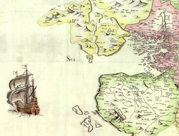
This detail is from the magnificent map of the county by Sir William Petty, originally published in 1685. Below is a larger section of the map, which includes all of Clew Bay. Kilgeever is named "Killoure". The names of the townlands are clearly visible - "Carrowmore", "Aghanny", "Askellan", "Carrowmore", "Doughmackeon", "Fermoyle" etc. |
|
|
|