Hill Walking Guide Books |
|
| n The Hill Walkers series from Shanksmare Publications The 30-35 routes in each of the books below range from short strolls to tough, all-day mountain walks. They are described in a practical no-nonsense style with a sketch map for nearly every route. There are attractive sketches and lots of general background information (eg recommended maps, public transport etc). Each book has 72 A5 pages and is in two colours to emphasise important points in the text and on the sketch maps. |
|
 |
NEW!
Hill Walkers Atlantic Ireland NEW! (ISBN 0 9531433 0 9 £4.95 Irish Pounds or sterling.) This book covers, in 34 routes, all the best one-day walks in the western seaboard of Ireland. The walks range from the graceful cone of Errigal in north Donegal to Gougane Barra in West Cork. A feature of the book is that extracts from Ordnance Survey maps are included so that it is not absolutely necessary to specially purchase these specially. |
|
NEW! Hill
Walkers South Kerry and West Cork NEW! (ISBN 0 9514547 7 3), price £4.50 Irish pounds or sterling). The mountains in the far south-west of Ireland have never been adequately covered in hill walking guide books. This guide includes all the mountains in this majestic area, including Sugar Loaf, Hungry Hill and the smaller peninsulas (and much more) in 30 routes, ranging in duration from a few hours to a long day. |
|
Hill Walkers Wicklow (Published 1997, ISBN 0 9514547 5 7 IR£3.75/ £3.95 Stg.) The Wicklow Mountains rise from the suburbs of Dublin and stretch for 50 km (30 miles) southwards. Because of its proximity to a large city this is the most popular walking area in the country. There is a series of fine peaks along the western side of the range, particularly around well-known Glendalough. Further south of it the range rise to its highest point at Lugnaquilla (925m). The western side of the range has long stretches of gently shelving moorland though there are also some fine peaks. Much of the Wicklow mountains are now in public hands as part of a national park. |
|
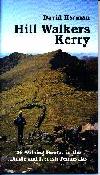
Hill Walkers Kerry (Published 1997, ISBN 0 9514547 6 5 IR£3.75/ £3.95 Stg.) Situated in the south-west of the country, this remote area is dominated by long peninsulas reaching into the Atlantic Ocean, the two northern-most of which, Dingle and Inveragh, are the subject of this book. Dingle culminates at its remote western end in Brandon (925m) and its satellites, which has one of the most magnificent settings of any mountain in the country. To its south, the whole of the large Iveragh peninsula, whose best-known town is Killarney, is an excellent hill-walking area. Close to Killarney is Carrauntoohil (1039m), the highest mountain in Ireland and the goal of the most spectacular of the several excellent ridge walks in the area. Most of the other high mountains in the country are in the immediate vicinity. |
|
Hill Strollers Wicklow (Published March 1998, ISBN 0-9514547-8-1 IR3.95) Within easy reach of Dublin, the amenity of the Wicklow Mountains offer a great range of pleasant walks ranging in length from an hour to over half a day, suitable for the more casual walker. Originally published in 1990, the book is now on its third reprint, in fully revised and updated form, including many new routes. Walks described included a wide range of terrains, from sea-cliffs to mountain summits and moorland, all of which are detailed with sketch maps and 'birds eye' views, a new feature to this series. Full details of rights of way, public and private transport, the country code and tips on working out your own routes are also provided. |
| Also available: | |
 |
This Way Up! (Published
1997, ISBN 0 9514547 9X IR£2.50) This book gives details of 64 routes in the Wicklow Mountains describing how to get from the road into open countryside. Because of housing, extensive forestry and farming on the lower slopes, a serious difficulty for hill walkers has been finding a way to the higher ground. Each route, given in the form of succinct description and a sketch map, solves this perennial problem. |


