|
|
|
 Aerial
photograph of Inishbofin and Inishark (30.2 kb) Aerial
photograph of Inishbofin and Inishark (30.2 kb) |
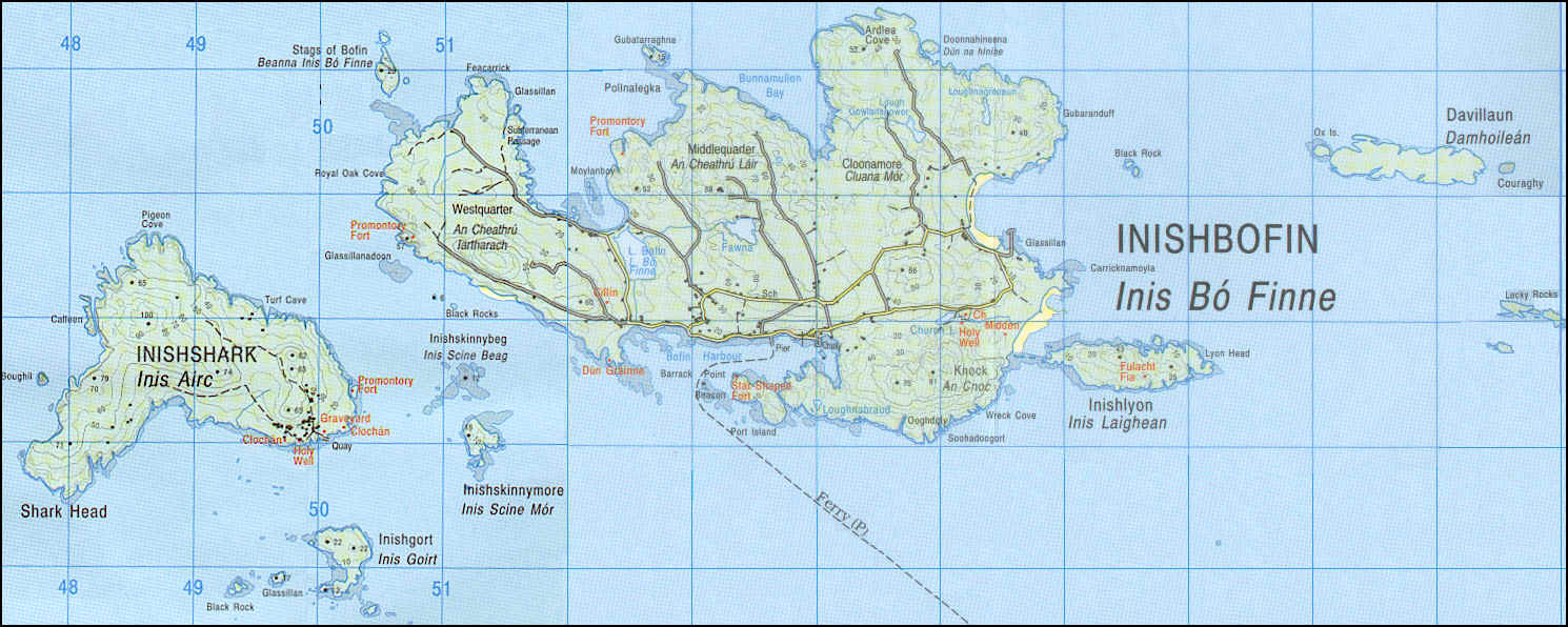
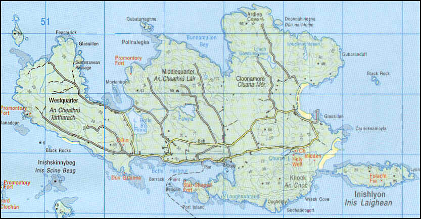
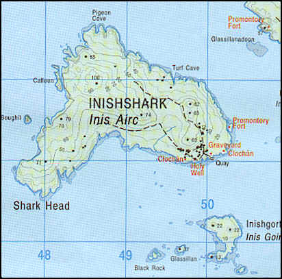
MAPS
& AERIAL PHOTOGRAPHS
OF INISHBOFIN
(Click on the photographs to enlarge them)
|
|
|
Aerial
photograph of Inishbofin and Inishark (30.2 kb) |
Maps extracted from the Discovery Series n.37 (Mayo-Galway) 1:50 000 |
Aerial photograph extracted from the Ordnance Survey Ireland, 1995; 1:40 000 |
|