| Home |
| News |
| Bulletins/ Information |
| Visitor Information |
| programme of events |
| Events |
| Entry Forms |
| Start List |
| Results |
| Gallery |
| Contacts |
| links |
| Sponsors & supporters |
|


|
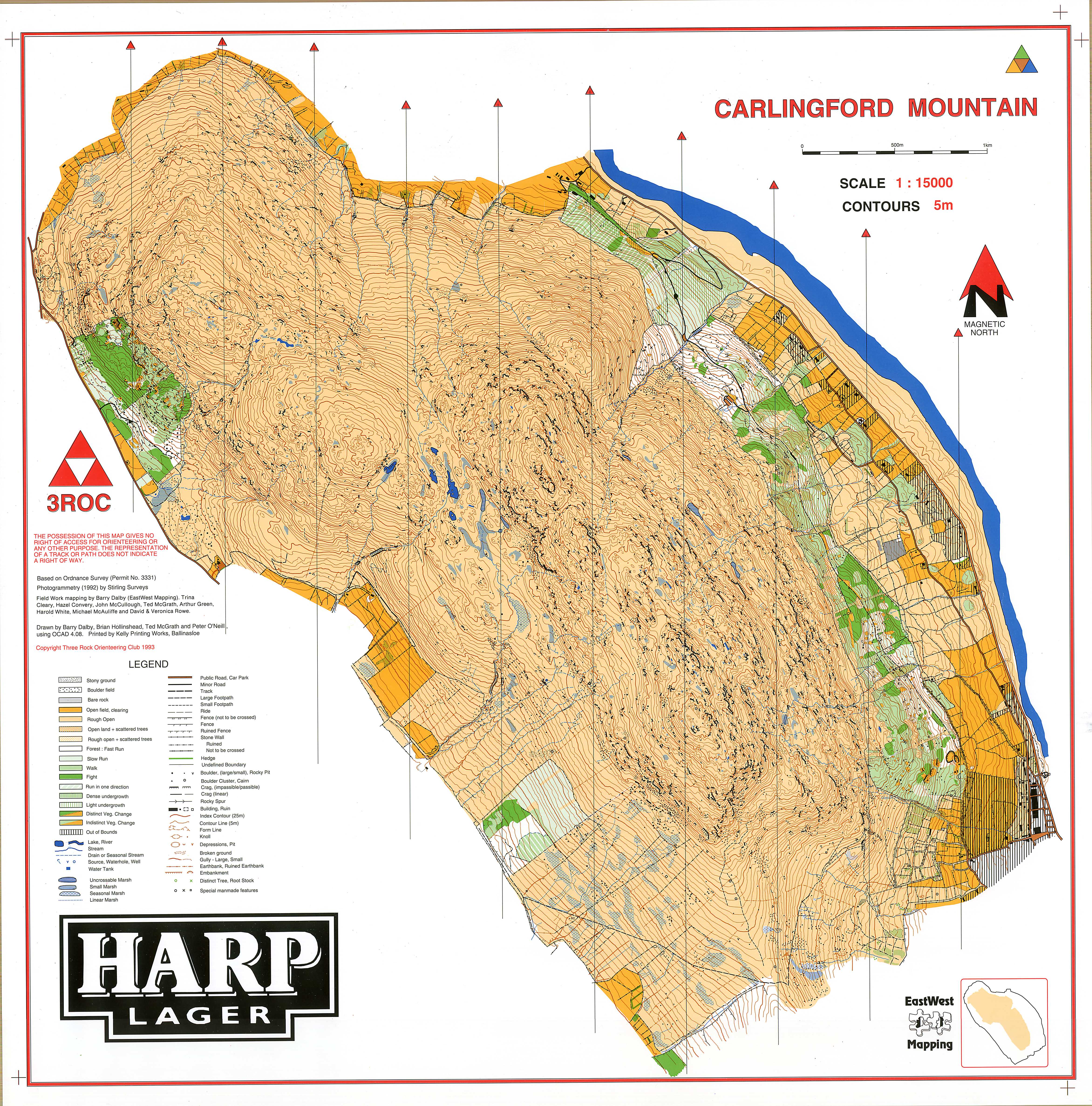
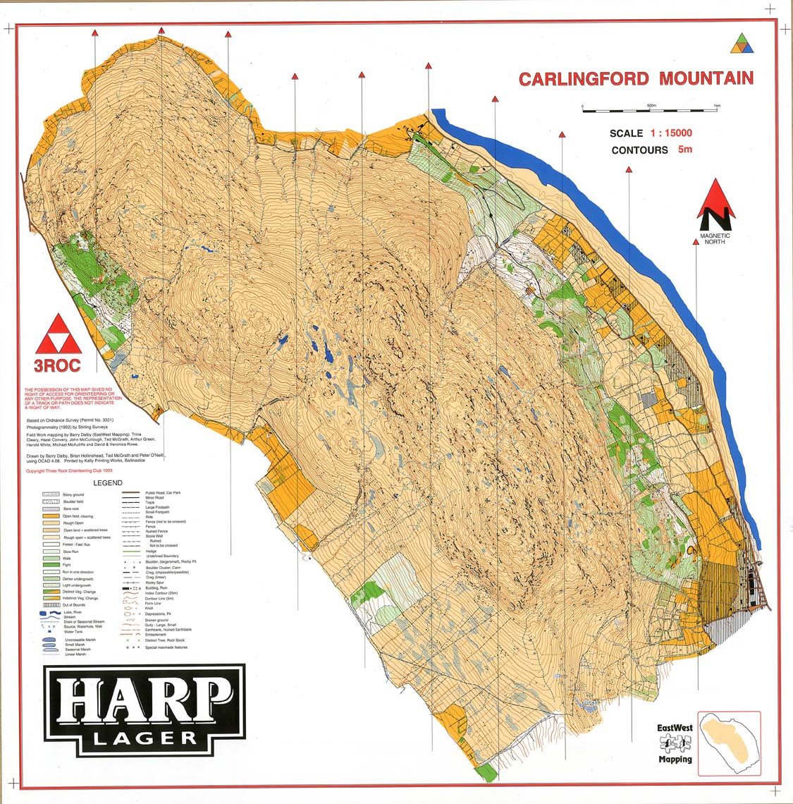
PREVIOUS MAP The map that covers the complete competition area was produced in 1992, and is available on this website. Copies of the map are available by post on receipt of €3.00. It is being revised for the event. Only the more prominent (over 1m) rock features are marked on the map. The crag symbol with tags indicates vertical crags. The crag symbol without tags indicates crags that form part of the slope but are still significant rock features.
|
