
|
|
|
|
|
|
|
|
|
|
|
|
Carrigeen
Choose a townlands from the map:
|
|
Townland
|
Acres
|
| Aglish North | 235 |
| Aglish South | 291 |
| Curraghmartin | 153 |
| Cussana | 58 |
| Mountneill | 315 |
| Portnahully | 288 |
| Ballygorey | 488 |
| Clasharoe | 56 |
| Corluddy | 331 |
| Cussana | 124 |
| Glengrant | 72 |
| Licketstown | 342 |
| Luffany | 444 |
| Moonveen | 326 |
| Portnascully | 396 |
| Ballincurra | 59 |
| Ballinlough | 53 |
| Ballymountain | 89 |
| Dungooley | 352 |
| Farranmacedmond | 140 |
| Rathkieran | 319 |
| Rathcurby
North |
124 |
| Rathcurby South | 277 |
| Ashgrove/Waddingstown | 319 |
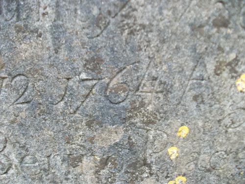
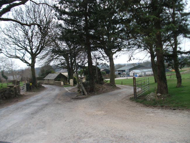
Carrigeen is situated just two miles from Mooncoin. There is a primary school (100+ pupils), pub, playcentre, community hall and church located in Carrigeen. Originally, Carrigeen was just a tiny area at the borders of the townlands of Corluddy, Licketstown and Clasharoe. The name 'Carrigeen', meaning 'little rock', was never a townland in its own right, and instead referenced a field name, most likely where the church is now. So most likely there was a 'little rock field' and a 'big rock field'. Everyone would have spoke Irish back then so hence the Irish naming. There was a large lump of sandstone that jutted out of the ground from the church yard going across the road and into the carpark of the current school. This rock was still there until tarmaced over in recent decades. However, a piece of this rock can still be seen at jutting out of the base of the old Carrigeen school/community hall. The road that goes to Licketstown village was cut through the rock,
With the building of the first 'Mass House' and later a church here in the early 1800s, the village that sprung up became a focal point for the area, overtaking Rathkieran. The current church in Carrigeen, dedicated to St Kevin, was built in 1893 by Fr Phelan on the exact same site of the previous church, which was built in 1801 by Fr FitzPatrick. There was no 'official' Catholic churches allowed before then.
The Banks
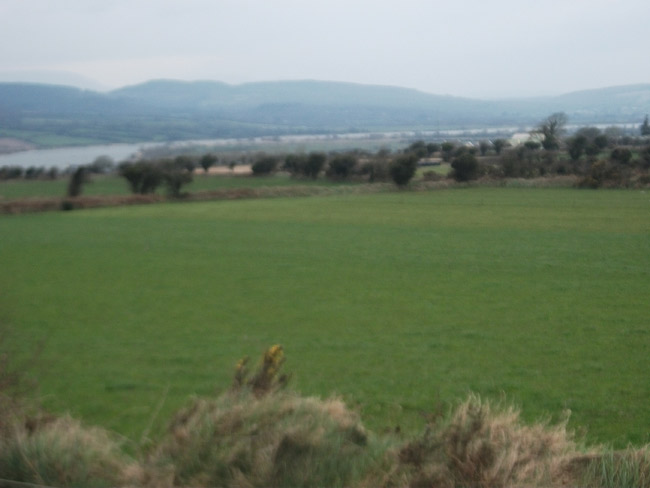
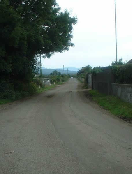
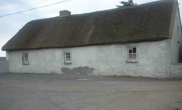
Carrigeen village has a number of unique features, which can be partially explained by it remoteness, especially the southern part of part of Carrigeen, which is on a 'u-bend' on the River Suir and basically peninsula-like, surrounded on three sides by water. The most southerly part of County Kilkenny and Ossory too. The high amount of thatch houses (vernacular homes) that still exist is one thing that make the area unusual, not just in Kilkenny, but in Ireland generally. Another is the famous 'banks' of Carrigeen. Locals on the southern end of Mooncoin parish will be aware the banks that were built up along the river shoreline in the late 1800s and early 1900s to stop the river flooding the land. In a bad winter, at high tide, hundreds of acres of land in the parish could be flooded. The banks stopped this, basically as a defensive wall. Now trees grow on top of these banks which why it is often difficult to see the River Suir in summer time even when you are very close to it!
'The high banks' around Carrigeen parish, however, are different and were not just by the river. They were located throughout the village. They were like high ditches of stone and earth, but people could actually walk and even cycle on top of them! They acted as land dividers, they also kept animals in, but judging by their location, they also acted as boundaries between the different townlands. Carrigeen was unusual for its time, in that it had a large number of landlords. So one landlord owned Licketstown and Moonveen (Congrieve's), all of Glengrant was owned by John Bucknall, another owned Luffany (Hugh Power) etc, etc. This is likely the division of land after the Cromwellian conquest as land had to be parcelled out to pay soldiers. The land in Carrigeen was high grade too, being in a fertile valley, beside the river transport network, and facing south to get optimum sun for crops. In other areas, one landlord could own thousands of acres, in Carrigeen it was divided up much more into smaller parcels. Mostly well under a thousand acres. So marking out the land with boundaries was important. It also likely cleared the fields themselves of stones as these were used to build the banks and perhaps this is another reason the local landlords initiated building them. Up until the 1960s, people walked the banks to get to Carrigeen Mass on a Sunday or school everyday. It was a shortcut. One came in at the back of the graveyard with steps to get down from it. Another bank came in from Licketstown to the churchyard/school. Other people remember, again up to the 1960s if not 70s, walking to Waterford 'on the banks'. It was much more direct than using the main road for people in Portnascully, Luffany, Corluddy, or Curraghmartin. Unfortunately, most the banks are now overgrown with trees and hedging, and look like the usual ditches/hedgerows.
Cots
Cots (a type of small boat) and snapnet fishing (where two cots work together to catch fish) are peculiar to the Nore, Suir and Barrow. This implies that it was settlers/immigrants to this area, many centuries ago, who brought in this type of fishing and boat building. However, the cots in Carrigeen/Mooncoin have been studied in recent years, and they even differ from cots used in the 'upper Suir' valley and on the other rivers. This is because the hull or bottom of the cot is more of a 'U' shape, as opposed to the more flatbottom boats elsewhere. We can surmise that cots in this parish were designed so they could be slipped up and down on the mudbanks beside the river, which are more prevalent on this part of the Suir due to silting, but not so much elsewhere.
Recent studies by an American researcher have compared 'Carrigeen cots' today to similar boats in Greenland and they are strikingly similar. Mainly in how they're built, i.e. where the spine and ribs of the boat are placed and the design of the keel. This is further evidence of viking settlers in Carrigeen in the 9th century. Greenland was also another viking colony. They would obviously have been very used to fishing in their Norwegian homeland and brought their technical skills to their new homes in Ireland and beyond. The methods used to build larger viking ships had the same basic principles as cot building. In Carrigeen and Mooncoin, the expertise in building cots was passed down from generation to generation for over a millennia now.
The expertise of Carrigeen fishermen was exported to Newfoundland, as some family members found themselves going to Canada for six months per year for the 'cod season'. Some family nicknames in the area even include 'codding', as in, families that used go catch the Canadian cod in the olden days!
Ballinlough
Ballinlough Creamery was opened in 1895. It was built at the location of the original Ballinlough Mill, ran by the Aylward family. That mill was in situ when Oliver Cromwell drew up his maps of the confiscated land in the 1650s making it a very old site indeed. There was a large mill pond and mill stream in front of the building.
When the Creamery opened, it incentivised local farmers to move to diary and sell their milk. The milk would be brought to creamery in churns and the fat separated and used to make 'Carrigeen butter' which was sold. The separated (skimmed milk), or 'back milk' (i.e. minus the cream) was given back to the farmers who then feed it back to their animals. So it was win win from them. In later years the cream was sent to the Miloko factory near Clonmel for chocolate making. The Creamery also sold items and foodstuffs needed on the farm. It was a big asset to have in a rural area, so longer journeys to town would not be required. All creameries went into decline when milk lorries were introduced which meant milk was taken directly from the farms. The Creamery closed down in the early 2000s after 100 years of operation.
 |
 |
 |
 |
|
Carrigeen Church, 1801 and mostly rebuilt in 1893 |
Carrigeen
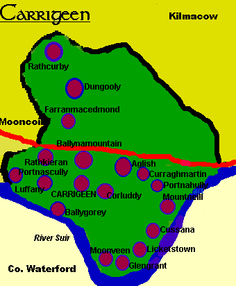
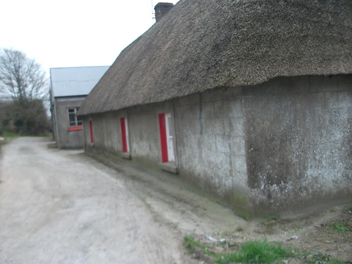
Hall / old girls school, opened 1858 |
Carrigeen
impressive Grotto, opened 1928 with stone brought from Mount Congrieve estate. Altar made in carra marble in Dublin |
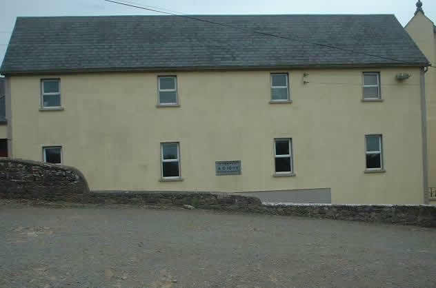
Carrigeen/Ballinlough
Creamery now closed |
 |
 |
|
Rathcurby
|
Rathcurby
|
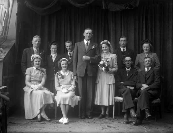 |
James Irish, Dungooley, Wedding. 1952 |
Farranmacedmond / Ballymountain
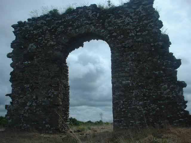
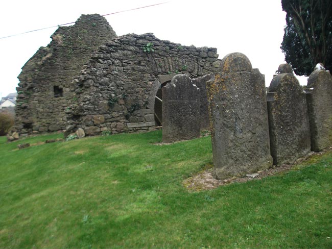
From Irish, Ballymountain; Baile na Mointeain - Town of the little Bog.Rathkieran (St Kieran's Fort or Rath) was once the main church for the whole area (mentioned in Ossory records as early as 1180) and can be considered the original focal point for the parish. The ruins of a church and graveyard can still be seen there today (built 1727). This church was Church of Ireland/Protestant but before the Reformation there would have been a Catholic church here. From the 1700s onwards, because of the fairly good relationship between the two religions, many Catholics were also given permission to be laid to rest at Rathkieran cemetery (and would have attended service here on occasion as there was, at periods, no places for them to worship). There has been many churches on this site. The present ruins are from a church built in 1727. Much of the ruins were removed in cir 1880 for safety reasons as the walls were said to be unstable. A dramatic arch is all that remains.
 |
 |
 |
 |
|
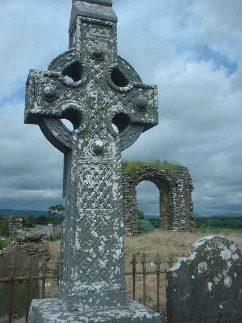
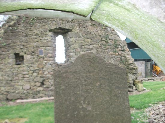
Rathkieran
Church
|
Rathkieran
Graveyard
|
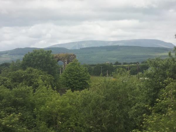
Rathkieran looking towards the Comeraghs (windmills in place since 2008) |
Rathkieran Quarry, monks were said to have lived close to here 1000 years ago. |
From Irish, 'Scullys Port/Fort', port is an ancient word for fortress, so 'Scullys Fortress'. A recorded entry in a religious book from 1240 states that 'Polsculi' had a castle, chapel and mill. It states that the church was part of the castle. There is remnants of an old church here, with graveyard. This church would have been Anglican/Church of Ireland after the Reformation. The feast of the Assumption of the Blessed Virgin is the feast day of Portnascully. Having a mill was an important sign of wealth, it also meant people were growing a lot of grain/ 'corn'.
 |
 |
 |
 |
 |
|
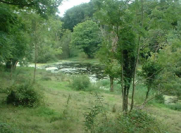
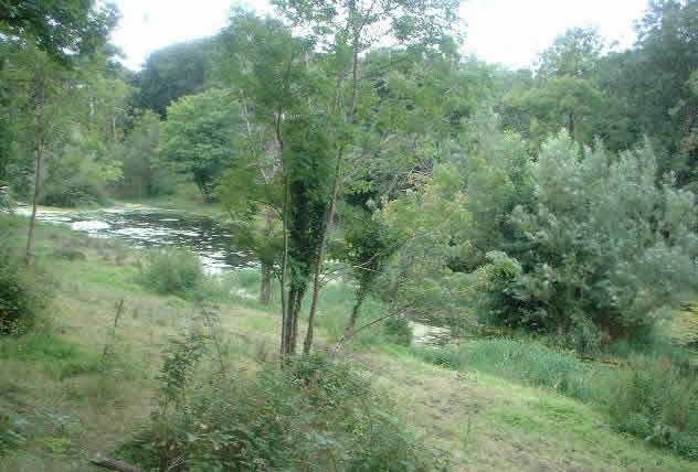
Portnascully Mill pond
|
Portnascully Church. A church in this area was first mentioned in 1240 which was attached to a castle. |
|||
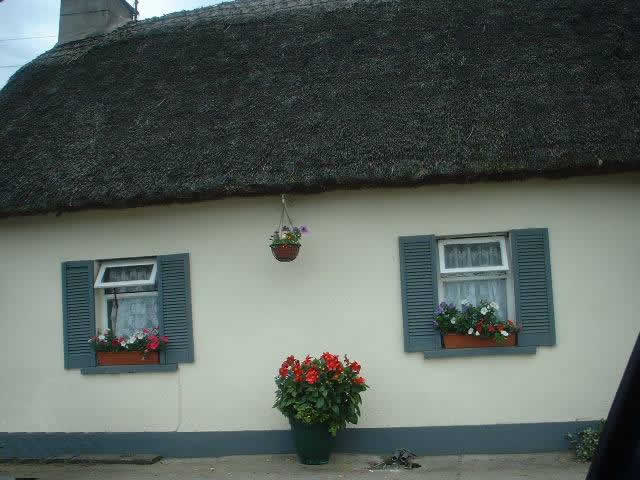
From Irish, it is translated as 'the wetland'. Made up of Luffany village, New and Old Luffany. It is a picturesque area, with one of the highest instances of thatch houses in Kilkenny (due the proximity of the river where the reeds are sourced). For such a small area, it has produced a number of famous inhabitants. Dr Walsh, one of the most popular Bishops of Ossory was born there. The village also has many All Ireland hurling medals accumulated by a number of different inhabitants. It must have one of the highest proportion of All Ireland medals per capita of population!
Watty Dunphy from Luffany village won an All Ireland in the 1922 final and was the first Kilkenny man to lift the newly acquired Liam McCarthy cup as captain that year. He was also the first person to captain Leinster to a Railway cup win in 1927. His nephew Joe Dunphy holds another unique distinction of captaining two All Ireland Minor winning teams. Still the only person to do that. Next up is Eddie Doyle, also from Luffany village, who captained Kilkenny to another All Ireland senior title in 1933. He also took part in the Sinnott's Cross ambush in 1921. His son Noel founded Suir Electric.
During the last century a Neolithic stone axe was found on Pat Dunphy's land. This means that people, our ancestors, were farming and working this land as far back as 5000 years ago.
 |
 |
|
Luffany |
|
Ballynamountain (Ballymountain)
From Irish, Baile na Móinteain, meaning 'Town of the Little Bog'.
From Irish, Ballygorey translates as 'O Guaires town'.
 |
|
View from Upper Ballygorey |
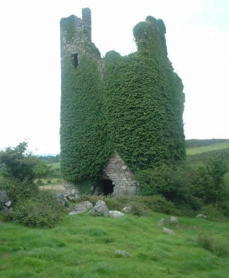
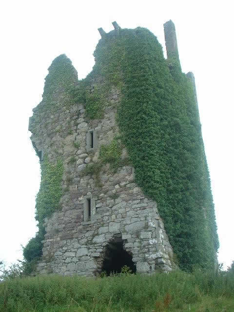
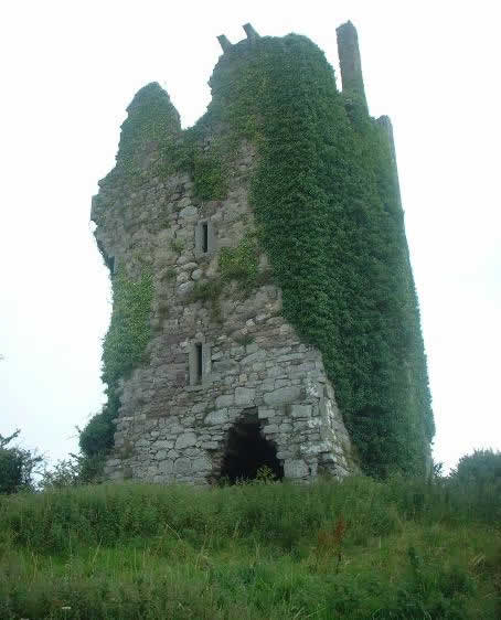
Famous for its five-story castle. The castle was the stronghold of the Grant family who were Constables of the Barony of Iverk. The castle was confiscated from the family by Oliver Cromwell in 1653, as they had sided with the the Kilkenny Confederates and the Duke of Ormonde. The extended Grant family - all descended from Sir Peter Grant who was granted the lands by the Butlers of Ormonde a century before for Knight service - owned castles in Corluddy, Dournane and Ballinaboley in Kilmacow. David Grant was then transplanted to Connaught in 1654. Up to 60 members of the extended Grant family were transplanted at this time. The Castle and land was taken over by one of Cromwell soldiers, Captain Jackson. His great-grandson met a bad end one night in the 1700s when, armed with a pistol, he met a tenant of his, a Walsh from Glengrant. They got into a row over rent and Walsh grabbed the gun, cracking it off Jackson's skull. The landlord died soon after and Walsh fled to the US the next day. The field opposite the bad bend in Corluddy, coming from Carrigeen village, is known as Poll an Murdair, the 'murder hollow' i.e. the place Jackson was killed.
Corluddy Castle is an example of a circa 1300s fortified tower houses, which were used to by the Norman settlers assert control of the areas, especially along the vital river transport routes.
Lost Village - Ballyfoy
Corluddy - just after the dip - was also home to the lost village of Ballyfoy. Nearly 100 people lived here up until 1827, when in the space of one day, they were evicted and their homes destroyed by bailiffs. Due to a poor wheat harvest that year, the locals had refused to pay their rents. It is perhaps not surprising that rebel poet, Watt Murphy, was living their at the time. He had started teaching at his father's private school there 20 years earlier in 1806, at age of just 16. As an only child, Watt had been given his father and mother's full attention and was extremely well educated for the time. His father had founded the school in the 1780s around the time Watt was born. It is likely Watt was one of the leaders in refusing to pay the rent to the local landlord, who was John Congrieve, of Congrieve House across the River Suir on the Waterford side. Congrieve obviously had no sympathy for the families and evicted them all. He also evicted some from Cussana for the same reason. Families were dispersed everywhere, mostly going to relatives. Many of them later ended up in Mullinavat, getting homes from the landlord there. Watt Murphy moved in with his cousins in Polerone and then started a school in Chapel Street. If there is anything positive to be taken from this traumatic event, perhaps it is that the enforced move meant Watt would later meet his beloved Molly in Polerone some twenty years later, and gift us our parish anthem, The Rose of Mooncoin.
 |
 |
 |
|
Corluddy Castle
1
|
Corluddy Castle
2
|
Corluddy Castle
3
|
From Irish, Aglish simply means 'the church'. There is only some small remnants of the old church and graveyard in the area. In its last use, the church would have been Church of Ireland. In the 'Red book of Ossory' (1600s), it appears as 'Ballymartyn', which could be in relation to St Martin. Hence this is why in old records we see the full name of Aglish as 'Aglishmartin' i.e. St Martins Church. When the main road to Waterford was being widened in the 1960s, skeletons from Aglish Church graveyard were dug up. The baptismal font from this church was saved in recent years and is now in place outside the door of Carrigeen Church.
 |
 |
|
Aglish
|
Aglish
|
From Irish, meaning is 'Martin's Moor'. It is not recorded if this is a specific Martin or 'St Martin' which corresponds to Aglishmartin, which it is taught references St Martin.
It is most famous in recently years as the birthplace of the 'rebel priest', Fr Patrick H Delahunty. As a curate in Callan, he led the Irish Volunteers in that town after the change in public attitude after the 1916 Rising. He became President of South Kilkenny Sinn Fein and helped raises money for the Dail Loan fund. He was arrested for this activity in 1920. During the Truce, in November 1921, he and 43 others tunneled their way to freedom out of Kilkenny Jail. None were recaptured. He laid low with friends in Mullinahone until after the Treaty was signed. During the Civil War he supported the anti-Treaty side and was sanctioned by his Bishop and not allowed to publicly minister. He went to the US but did visit home on occasion and was in Curraghmartin on holidays in 1950 and 52. He died in 1955 and was buried in Kansas. He had worked as a prison chaplain in later life, an environment he knew all too well.
From Irish, 'Bank or Port or Fort of the Rock'. The anglicised 'Port' often originated as 'fortress' but in this instance its likely to do with 'bank' or port, a place to park and launch boats.
Original Irish name is 'Baile salac/slóch' or 'Dirty town', later name comes from the Neill family who were based here.
 |
 |
 |
|
View
from Mountneill |
||
From Irish, literally means 'Full of Paths'.
From Irish,' the town of Licket' (Licket being an English surname). Licketstown was said in local lore to be the 'oldest village in Ireland'. This is most likely due to immigrants who settled here along the banks of river, having sailed up the Suir. All their houses would have been packed close together for security purposes, as well as protecting each other from the wind that blows down the Suir Valley. Most likely the original settlers were viking (norwegian) in origin, as the vikings built their initial Waterford base just 1km up down the River Suir, opposite where Granny Castle is today (none of this town remains. Another piece of evidence is the to suggest viking origin is the use of cot boats, the design of the cots is strikingly similar to viking building methods, even to this day, past from generation to generation.
 |
 |
|
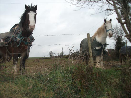
Licketstown horses
|
|
Literally meaning 'Grants glen'. This is the most southerly point in County Kilkenny and also the most southerly point in Ossory, which stretches as far north as County Offaly. The Grant's were a very powerful family in the area (Corluddy and Polerone castle was owned by them) up until 1653 when they forfeited there lands by siding against Oliver Cromwell. They moved to Connaught subsequently and are listed in the 'transplantees' on the History page of this site.
Glengrant was also the birth place of Bob O'Keeffe, winner of an All Ireland with Laois in 1915 (a teacher based in Borris in Ossory) and who later became President of the GAA. The current and previous senior Leinster Hurling Championship trophies are named after Bob.
 |
 |
 |
|
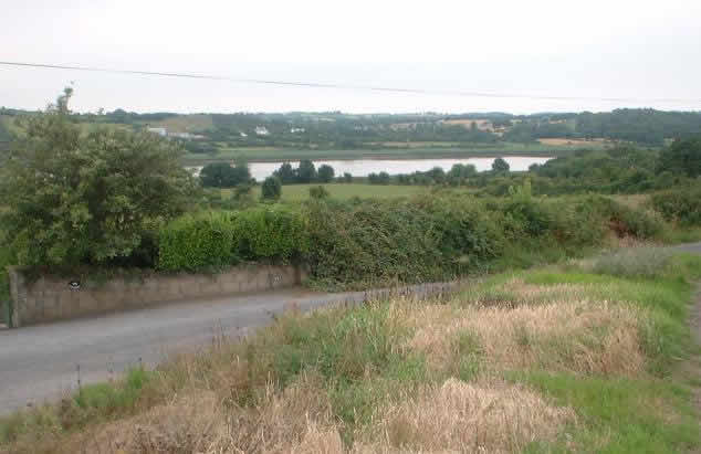
View from
Glengrant
|
Glengrant Village | |
 |
|
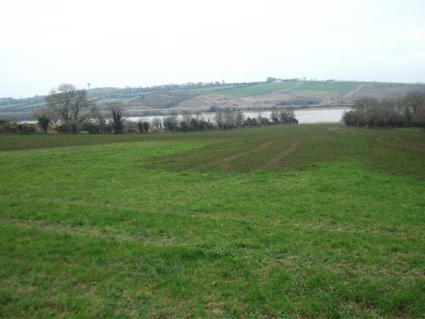
View from Moonveen in the south of the parish |
Meaning 'smooth bog', there is also beautiful wood in this townland. One man born in Moonveen would be become a famous writer and journalist in later life. Pádraig Puirséal was born in 1914, his father, Richard, originally from Ballyragget, being the principal of Carrigeen national school until 1938. Puirséal would go on to write four novels, his 1942 work, 'Hanrahan's Daughter', being translated into several languages. He would become more famous in later life as the chief sports writer in the Irish Press newspaper. He was also a founding member and judge of the GAA All-Stars in the 1970s. His wife, Agnes, was also President of Camogie Association. He died in 1979.