| Home | - | Events | - | Guiding Ireland | - | Resources | - | Raheny | - | Worth Checking! |
Raheny - Rath Éanna
Raheny (previosuly spelt as Rathenny, Ratheny etc.), has been the name of this district for many centuries (it was noted re. 570 AD as Rathena). The name comes from the Irish, Rath Éanna, meaning "the Fort of Éanna".
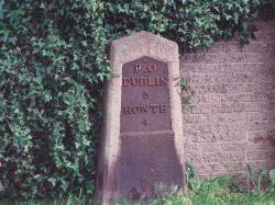
Raheny is an extensive coastal suburb of the city of Dublin in Ireland, centred around an old country village. It lies four to five miles from the city centre on a (north) easterly main road, the Howth Road, which goes to the historic Hill of Howth (Binn Eadair), at the northern end of Dublin Bay, some miles beyond.
Some Key Features of Raheny:
- Dublin's second largest park, St. Anne's Park (parts of which lie in Clontarf),
assembled by the Guinness family of brewing fame.
- The internationally recognised (North) Bull Island, containing Dollymount
Strand. The island is a National Nature Reserve and UNESCO noted site, which lies off
the coasts of and is shared between Raheny and Clontarf.
It is quite recent, having formed following works, such as the North Bull Wall, in Dublin Bay. The water off the coast was called Raheny Lake and Crab Water and is sometimes referred to today as the Blue Lagoon. - The Holy Wells: the site of the Holy Well of St. Anne, now dry, can be seen in St. Anne's Park. The Holy Well of St. Assam, patron saint of the area, is now concealed but lay within church grounds.
- The famous Crescent of cottages in the heart of Raheny, built by Mr. Samuel Dick for servants and left in Trust for the benefit of the local school (seven of the eight houses are still held by a successor Trust).
In 1014, the famous Battle of Clontarf was fought and the lands of Raheny formed part of the battle area, though not a central one. The main battle line ran from the Tolka for about two miles towards Howth and tradition places a command post here, perhaps at the site of the old fort, with its shielding river. There would have been fierce fighting towards the coast, especially around the Naniken/Maryville boundary.
The community of Raheny have set up a Website with information on events happening in the area and the history of Raheny and the surrounding area. For more information you visit this site at www.raheny.com. Also there are articles from the Raheny Heritage Society at www.raheny-online.com/heritage
| Web Search |