|
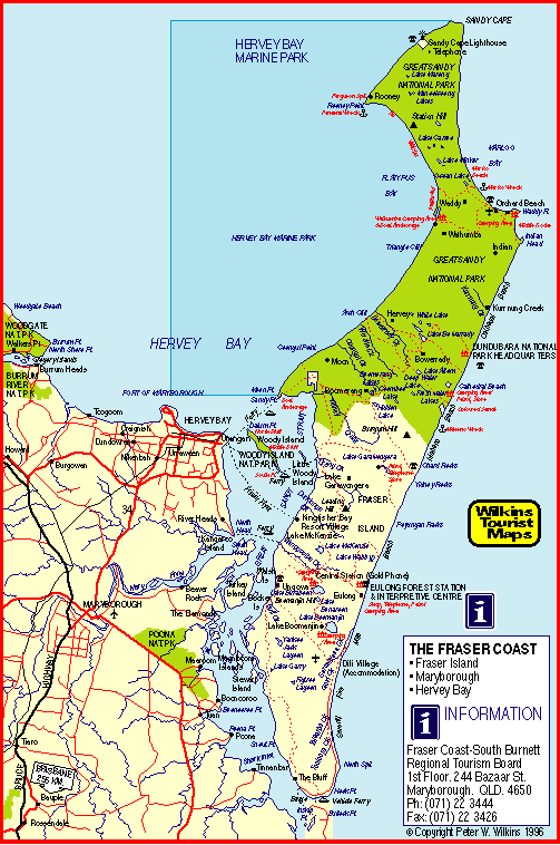
 Aboriginal legend tells us that The Coloured Sands were
formed as follows:
Aboriginal legend tells us that The Coloured Sands were
formed as follows:
"Way
back in dream-time, there lived on the banks of the Noosa
River a beautiful black maiden called Murrawar who fell in
love with the Rainbow, which came to visit her here every
morning. She would clap her hands and sing to this lovely
rainbow.
"One
day the Burwilla, a very bad man from a distant tribe,
stole Murrawar for his slave wife, beating her cruelly and
making her do all his work, while he sat in the shade
admiring his terrible killing boomerang. This boomerang
was bigger than the biggest tree and full of evil spirit.
"One day Murrawar ran away and as she hurried along
the beach, which was all flat in those days, she looked
back and saw Burwilla's boomerang coming to kill her.
Calling out for help, she fell to the ground too
frightened to run.
"Suddenly
she heard a loud noise in the sky and saw her faithful
Rainbow racing towards her across the sea. The wicked
boomerang attacked the brave Rainbow and they met with a
roar like thunder, killing the boomerang instantly and
shattering the Rainbow into many small pieces.
"Alas,
the poor sick and shattered Rainbow lay on the beach to
die and is still there with all its colours, forming the
hills along the beach."
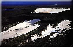
Geologists
say that the sands are stained by decaying vegetable
matter as it seeps through. Geologists are full of shit.
Ā
|
 INTRODUCTION
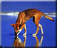
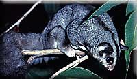 (Pictured left is a sugar glider and, right, a dingo)
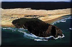
 The
Coloured Sands
The
Coloured Sands