| |
|
|
|
|
|
|
|
|
|
|
| |
|
|
|
|
|
|
|
|
|
|
|
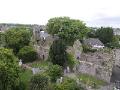
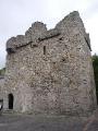
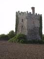
Ballyhoneen lies the north side of the Dingle peninsula just below Lough Adoon a corrie lake located in one of a series of glaciated vallies on the northern side of the central mountain range running the lenght of the peninsula(Cuppage). In this area over 72 sites are recorded by the Archaeological Survey of Ireland. In Lough Adoon itself is a small low lying island called Dooneen Island. The eastern tip of the island is separated from the shore by about 30m of very shallow water. This end of the island has been fortified with a drystone wall over 2m high in places and 2.5 m thick set back 3 to 5m from the shore line on this side of the island (Cuppage). This structure has not been dated so it could be prehistoric in origin or date Early Medieval preiod. 
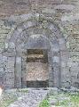
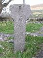
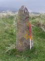
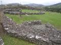
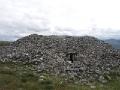
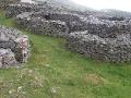
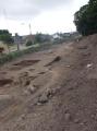
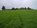
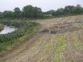
Below the lake the current landscape of the widening valley consists of a mix of gorse and cutaway bog either side of the Scorid river which runs from Lough Adoon. In is in this landscape that traces of what is thought to be an early Bronze Age settlement landscape can be found. Scattered in the area are hut sites, enclosures, Fulacht Fia, Standing Stones and a Wedge tomb which are common monuments from this period. Rock art is also to be found in the valley Wedge tombs are dated to 2400 - 2000BC the transition from the Neolithic to the Bronze Age. The wedge tomb at Ballyhoneen is sited on the summit of a low hill rising from the east bank of the river. The tomb is in good condition though as common with most surviving wedge tombs, no visible traces of a cairn survive. Three Rock art motifs are to be found on the Wedge Tomb recorded by Cuppage during his survey and later studied by the late Dr Blaze O'Connor. Her recording of the rock art can be viewed on the EuropreArt site. Inside the tomb on one of the roof slaps is a line of closely spaced small cups. One of the orthostats has a cup and ring motif, On the external surface of the large roof slab, a single cup mark adjacent to a penannular ring lies in the centre of this large stone. Also on the hill are two standing stones, one of which also has possible rock art motifs. Two possible cup marks are recorded on this standing stone.(Cuppage) Erosion and the cutting of turf have revealed an extensive series of prebog field walls. The field system appears to be irregular(Cuppage). In places the field walls consist of a double face of of low orthostats with a rubble core. Some survive as single lines of boulders or low orthostats. Several enclosures and possible hut sites also can be seen on the slopes above the river. Several Fulacht Fia sites common in the Bronze Age are also recorded in the area. One site located on the bank of the Scorid river is now being eroded by the river. It is composed of a mix of fragments of burnt stone and black soil. The now deserted valley would appear to have supported sizable settlement activity in prehistoric times.
Bibliography
|
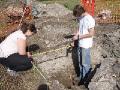
Site VisitMy visit to Ballyhoneen was made in late May 2011. | |||
 |
 |
 |
 |
 |
 |
 |
 |
 |
 |
 |
 |
 |
 |
 |
 |
 |
 |
 |
 |
 |
 |
 |
 |
Site Location
(www.archaeology.ie) |

|
| Next > |
|---|