|
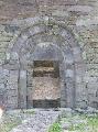
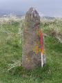
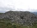
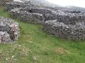
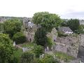
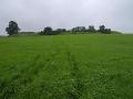
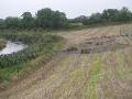
Dowth Henge is located on private property about 1km south east of Dowth passage tomb on the same ridge overlooking the eastern end of the bend in the Boyne. Geraldine Stout has documented 13 embanked enclosures in County Meath four of which, including Dowth Henge, are in Br· na B¾inne. These embanked enclosures consist of an oval or circular space surrounded by an earthen bank constructed by scooping soil from the interior creating a dome shape in the interior. The bank surrounding the enclosure at Dowth is up to 20m wide in places and ranges from 3m to 5m in height. The oval enclosure is 165m north-west/south-east by 175m north-east/south-west. There are now two entrances to the enclosure through the surviving surrounding bank but it is thought that originally there would have been one entrance to the enclosure situated on the south west side.
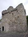
Dowth Henge has been described as the most spectacular and best preserved of these embanked enclosures in Br· na B¾inne. These enclosures post date the passage tombs and are likely to have served some ceremonial purpose.
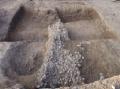
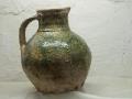
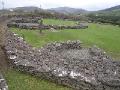
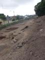
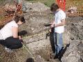
A rescue excavation was undertaken by David Sweetman on the embanked enclosure at Monknewtown in the early 1970s. The excavation uncovered twelve pits, some of which contained cremated bone, including some in a Neolithic Carrowkeel bowl, and a ring-ditch. Within the enclosure an early Bronze Age house and associated Beaker pottery was found. It is thought likely to date from a period following the abandonment of the henge for ceremonial use.
Bibliography
- Sweetman, D. 1976. An Earthen Enclosure at Monknewtown, Slane, Co. Meath. Proceedings of the Royal Irish Academy. Section C: Archaeology, Celtic Studies,History, Linguistics, Literature, Vol. 76, pp. 25-73
- Stout, G and Holloway, D.H. 1991. Embanked Enclosures of the Boyne Region. Proceedings of the Royal Irish Academy. Section C: Archaeology, Celtic Studies,History, Linguistics, Literature, Vol. 91C, pp. 245-284
- Condit, T. 1997. Late Neolithic Ritual: Earthen Ceremonial Enclosures. Archaeology Ireland, Vol. 11, No. 3, Supplement: Br· na B¾inne, pp.22-23
- Condit, T. 2001. High over Meath: Selections from a 'Royal' Plane. Archaeology Ireland, Vol. 15, No. 2, pp. 24-27
|