Resurrecting Monuments Community Archaeology Project |
|
 |
Resurrection Monuments is a new community based archaeology project based in Baldoyle. The project has its origins in the successful Grassroots Archaeology project (2013-2014)a community archaeology project in Baldoyle which investigated a crop mark (DU015-018) identified by the Archaeological Survey of Ireland after the Seagrange housing estate was built on the land in 1973.
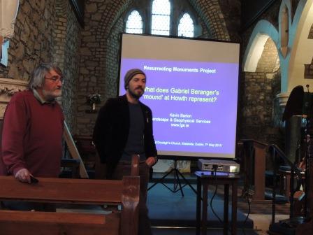
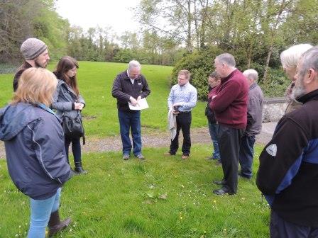
The project Resurrecting Monuments Communities reclaiming heritage has received grant funding from the Irish Research Council (IRC) under the New Foundations Grant Scheme 2015. The research work being undertaken by the project will be coordinated by Grassroots Archaeology and the Baldoyle Forum, working alongside Professor Gabriel Cooney of UCD. Fingal County Council will also take an active part in the project through their Heritage Officer Dr. Gerry Clabby. The core project group comprises a mix of interested local people, local historians, amateur archaeologists led by local man Paul Duffy a professional archaeologist and supported by Heidi Bedell and the Baldolye forum. |
For its initial research work the project is targeting four sites in South Fingal.
- The Burrowfield Mound known as the Knock of Howth(DU015-019)
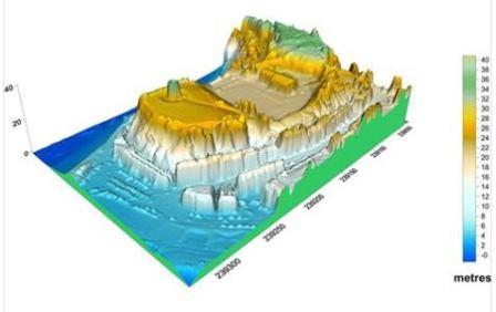
- Tower Hill site of the Hurdygurdy Radio Museum is a possible Norman Motte (DU016-002001)
- Dungriffen (The Bailey) Promontory Fort (DU0-016003)
- An enclosure at St. Doulaghs church which has been identified by geophysical survey (DU015-009009)
Resurrecting Monuments Facebook PageA project facebook page has been launched to post updates on progress at Resurrecting Monuments Community Further updates on the projects progress over the coming months will also be published on this site. |

|
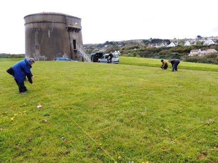
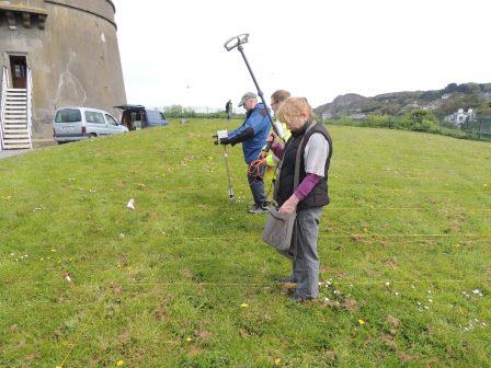
Resurrecting Monuments Tower Hill Excavation and Heritage Week Event |
Tower Hill Excavation 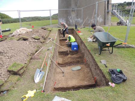 The Project team have completed their week long excavation on Tower Hill Howth. For a summary of the days on site and photos of the excavation see more at Tower Hill Excavation The Project team have completed their week long excavation on Tower Hill Howth. For a summary of the days on site and photos of the excavation see more at Tower Hill Excavation
Tower Hill Heritage Week Event
The end of the week saw the group host a hertiage week event on Tower hill supported by Fingal Coumty Council, bringing to life the story of a forgotten monument. The sucessful event gave the many visitors a vivid insight into the detail of past lives through a showcase of archaeological fieldwork and research undertaken by the Resurrecting Monuments Group supported by the Claiomh living history group, Wicklow Willow, Past Visions and a disply and demo of the remote sensing technology now used in archaeology by Landscape and Geophysical Services. Some photos from the day available to view at Tower Hill Excavation
|
Burroughfield Mound|
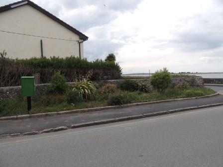 | This site (DU015-019) is a possible prehistoric Burial Mound known locally as the Knock of Howth. It was levelled in the 1930s. The site is on the coast in Baldoyle partially on council greenspace and partially in private residence. The project will initially carry out desk based research on this site. |
|
|
Dungriffen Promontory Fort|
|
| 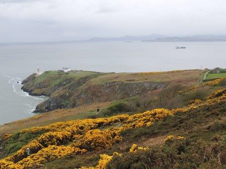 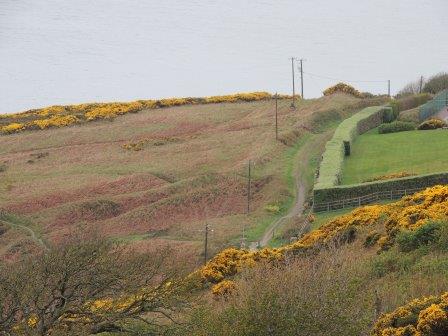 | Anonymous to tourists and locals alike, not many people know that the promontory extending from the south east tip of Howth Head with Baily Lighthouse complex at its eastern tip is the site of a large promontory fort, Dungriffen which may date back to prehistoric times. One of seven promontory forts off the coast of Dublin, Dungriffen Promontory Fort (DU0-016003) is of a similar scale to the better known Drumanagh Promontory fort at Loughshinny north of Rush. The project group plan to carry out extensive desk based research on Dungriffen
and a survey of the site this year. In the early 20th century a similiar survey was undertaken by the antiquarian Thomas Johnson Westropp. |
|
St Doulagh's |
 | An enclosure (DU015-009009)was idenified by a Geophysical survey undertaken in the field to the north of St Doulaghs church. The results of the geophysical survey show a large sub-circular enclosure with internal divisions. Subject to license approval, the Resurrenting Monuments project hopes to undertake some focused small scale, test excavations to try and date this feature which may relate to the Early Medieval origins of St Doulaghs. |
|
| Last Updated ,Sept 2015 |