

| Genealogy Research Service Ireland by Bruce Chandler |
|
|
|
||
| If you find my work useful, help me continue it by CLICKING on my advertising links. | ||
|
| ||
| VIEW MAPS | DISCOVERY | GRIFFITH | ORDNANCE | TOWNLAND INDEX |
|
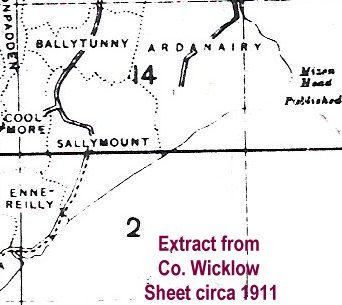
Townland Index Maps Ireland is divided in counties, then baronies, then parishes, then townlands. Baronies are defunct now but it is useful to know where they are as they are used in sub-dividing county townland indexes in the Registry of Deeds. When searching on a map for where your ancestors came from in Ireland, you need to look at a Townland Index map to see where townlands are in relation to each other and see their boundaries. These maps are on sale in the Ordnance Survey Map Sales Office, Phoenix Park, Dublin. Counties like Meath and Cavan are covered by six individual maps per county whereas Dublin and Wicklow have just one map each. The cost of each map is currently five euro. The maps were printed around 1911 and I reproduce part of one on left below for example. The essentials are the physical boundaries between each townland. |
|
| Townland Index Map c1911 | Discovery Series Map 1995 |
 |
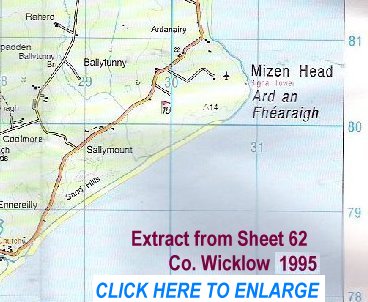 |
| Discovery Series Maps These maps are in colour and show topographical detail - mountains, contours, woods, bogs, rivers, buildings, roads, railways. They are up to date and and I reproduce part of one on right above for example - using the same area as for the townland index map example to let you see the difference. Discovery maps also show townlands but without their boundaries. I find Discovery maps are more useful to have around as they can be used both for modern touring and for genealogy. They cost seven euro, ninety cent each and there are at present ninety one numbered maps to cover all thirty two counties in Ireland. They can be bought at good Irish newsagents, book shops or at Ordnance Survey Map Sales Office, Phoenix Park, Dublin. Click Here to view map of Ireland showing how it is covered by numbered Discovery maps. |
|
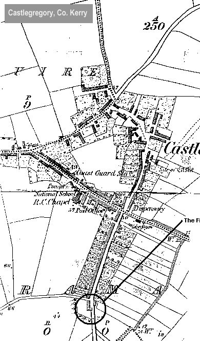
| Ordnance Survey These black and white maps at scale 6 inches to the mile are available for viewing on microfiche at the National Library, Kildare St., Dublin 2 and at Dublin City Library,Pearse St., Dublin 2. They are essential to look at because they represent the first mapping of Ireland using scientific methods. To view a map you ask for the appropriate microfiche after studying the Ireland map grid reference available at the library counter. I find Dublin City Library better to use than National Library simply because their viewers all have the facility to print off pages, either of A3 or A4 size. Ordnance Survey maps date from 1837with revision maps from around 1889 and 1937. They are available on microfilm in National Library. I show an extract of the 1889 Ordnance Survey map alongside a Griffith map of the same village below. |
|
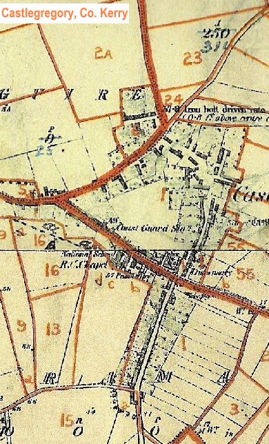
| Griffith Valuation Maps These maps are available for inspection and purchase at the Valuation Office, Irish Life Centre, Lower Abbey St., Dublin 2. The maps were made around 1911 and show each individual property or lot bounded in red lines, on the background of the 6 inch Ordnance Survey. Using these maps you can see where exactly your ancestors had their land. Individual maps cost 40 euro each but it is possible to have a small section of a map copied for 10 euro. This is about enough to cover say two or three townlands. When using these maps in conjunction with the data from 1854 Griffith Valuation, you must remember that you are not comparing like with like. To be really accurate you must first compare 1911 Griffith data from the Griffith Revision Book with the 1911 map. Then you have to make allowance for how the lots on the map would have appeared in 1854. You will not get an accurate view of 1854 on a map until you do this and the reason is that there were a number of lot amalgamations and divisions between 1854 and 1911. |
|
| Griffith Map c1911 | Ordnance Survey Map c1889 |
 |
 |