News, 21 March 2004
Club Maps
At the Club AGM held on the 9th of March, the mapping officer presented his report. Since a number of points were raised in the report which are crucial to the future of an orienteering club such as 3ROC, the report is reproduced below for the benefit of those club members who were not able to attend the AGM.
If you would like to try your hand at map making you can download a copy of the full free version of OCAD6 from the OCAD Website. The OCAD site also has links for finding the new specifications for the control descriptions which became effective on 1 Jan 2004.
Mapping Officer's Report for 2003/4.
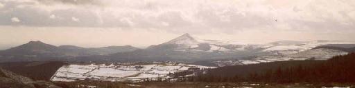
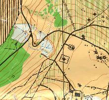
The main mapping effort by the Club in the past year was concentrated on updating Clarabeg. This task has now been successfully completed and the new map will be used for the Spring League event which the Club is running in April.
Clarabeg has now been resurveyed
In addition, some on-going work is being done in updating Three Rock Mountain. However, there is still a considerable amount of updating yet to be done on this map. No work has been carried out on any of the other maps held by the Club although corrections being done currently for the Army Orienteering championships in Glendalough will be made available shortly to the Club. No new areas or areas with potential for mapping were identified during the year.
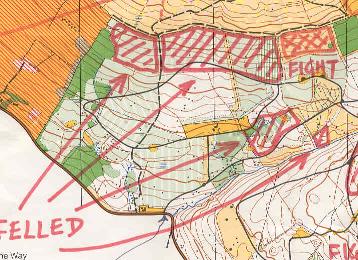
We had two successful "Update Clarabeg Days" in the early Summer during which the forested area to the South was blitzed by a team of volunteers.
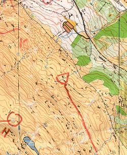
The format used involved dividing a manageable area into sections and then getting the surveyors to review the sections and carry out corrections in the field on a 1:5000 base map. This information was given to the mapping officer at the end of the day and was used to update the base map file in OCAD. Up to 10 club members at a time, working in pairs, took part in the surveying. They included Trina Cleary, Ted McGrath, Nigel Campbell-Crawford, Gary Tully, Brian Lawless, Eoin, Nadya and Scott Dunne, Monica Nowlan, Vera Murtagh, Claire and Brendan McGrath and John McCullough. Other areas, particularly the open mountain, have been updated by the mapping officer with the assistance of GPS (kindly lent by Brian Hollinshead).
Transmitters on Three Rock
New opportunities have opened up on Three Rock with some thinning of the forest on the east side and the occurrence of an extensive gorse and heather fire early in 2003. When the thinnings have been cleared the forest will become runnable while, on the open mountain, the burnt areas are now runnable and many boulder features which had not previously been mapped are now clearly visible. Recent experiences with using GPS on the open mountain have been very promising and it should be possible using GPS to bring this section of the map up to date fairly quickly. The continued improvement of the Three Rock Mountain map should now be treated as a priority by the Club given the value of the area to Orienteering and the Club.
In common with most other clubs, map production by the Club is now exclusively digital using OCAD and digital printing or colour photo-copying. This means that corrections and updates can now be much more easily added to the maps and partial maps can be produced or scales varied as required.
In the past few years we haven't made any real forward progress as far as mapping is concerned. We have held our own in updating Pine Forest, Three Rock and Clarabeg - all areas that have limited potential or are suffering from over-use. The dwindling membership of the Club makes it harder to undertake any more work.
Carlingford to be used for VHI
The reality of the situation is that while we do have the capacity within the Club to do updating work we could not undertake any major mapping project other than with the assistance of professional mappers. Even using professionals there is a considerable amount of base work which would still fall to be done by the Club. Professional mappers are unlikely to be interested in, or cost effective, for small tasks. Of course, we have yet to identify another Carlingford for such an undertaking. Nevertheless I would strongly advocate that the incoming committee should set such a task as a high priority. After all, we cannot continue to do orienteering without maps.
B McGrath - 5/3/2004.3ROC Mapped Areas Summary
Note *= digital file - scale can be varied.
Pine Forest 1:10,000*
Medium - needs further updating. Local Map updated in 2001. Area restricted by limited car parking and deterioration of runnability.
Phoenix Park 1:10,000*
Good. Park. Updated around 1998. Large supply of printed maps in stock with some errors.
Glendalough 1:10,000*
Medium. Grade 2. Last updated in early 1990's. Changes in vegetation. Now in need of updating. Access can be a problem for organisers.
Three Rock Mountain 1:10,000*
Medium. Grade 2. Club's main asset - much used. Partly updated in 2002. Updating to continue.
Clarabeg 1:10,000*
V Good. Grade 2. Much used area. New update ready for event in April 2004. Access/parking difficult. Forested area much overgrown.
Carrick Mountain
Out of date. Map out of stock. Area much overgrown.
Tiglin
Out of date. Map out of stock. Area much overgrown or felled.
Carlingford 1:10,000*
V Good. Grade 1. Now 12 years old but still top class area.
Carlingford 1:15,000*
V Good. Grade 1. Now 12 years old but still top class area.
Foxes Rock 1:10,000*
V Good. Grade 1. Now 12 years old but still top class area.